Jeffersonville geodata
Jeffersonville (Indiana) is a seat of a second-order administrative division; located in United States in America/Kentucky/Louisville (GMT-4) time zone. With population of 46,960 people, there are 1023 cities with bigger population in this country. Compared to other cities in United States, 60.1% of cities are located further ↑North; 53.7% of cities are located further ←West and 63.1% of cities have higher elevation than Jeffersonville. Note1
Administrative division(s):
- Level 1: Indiana
- Level 2: Clark County
- Level 3: Township of Jeffersonville


Jeffersonville GPS coordinates[2]
38° 16' 39.252" North, 85° 44' 13.848" West
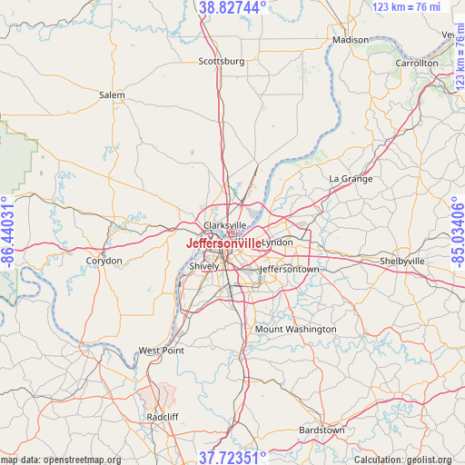
| Map corner | latitude | longitude |
|---|---|---|
| Upper-left | 38.82744°, | -86.44031° |
| Center: | 38.27757°, | -85.73718° |
| Lower-right: | 37.72351°, | -85.03406° |
| Map W x H: | 122.7×122.7 km | = 76.2×76.2mi |
| max Lat: | 71.29058° ⇑60.1% North |
| Jeffersonville: | 38.27757° |
| min Lat: | ⇓39.9% South 19.06759° |
| min Long | Jeffersonville | max Long |
| -171.73463° | -85.73718° | -66.98998° |
| W 53.7%⇐ | ⇒46.3% E |
Elevation
Elevation of Jeffersonville is 138 m = 453 ft, and this is 156.8 m = 514 ft below average elevation for this country.
| Max E: |
3189 m = 10463 ft | 63.1% |
| Avg. | 294.8 m = 967 ft | |
| Jeffersonville | 138 m = 453 ft | |
Min E: |
-60 m = -197 ft | 36.9% |
See also: Jeffersonville elevation on elevation.city.
Geographical zone
Jeffersonville is located in North temperate zone (between Tropic of Cancer and the Arctic Circle). Distance of this Northern Tropic circle is 1650.1 km =1025.3 mi to South.| Distance of | km | miles | from Jeffersonville |
|---|---|---|---|
| North Pole | 5751 | 3573.5 | to North |
| Arctic Circle | 3145.1 | 1954.3 | to North |
| Tropic Cancer | 1650.1 | 1025.3 | to South |
| Equator | 4256.1 | 2644.6 | to South |


Nearby cities:
15 places around Jeffersonville: (largest is in red/bold)
• Audubon Park
8.3 km =5.2 mi,  172°
172°
• Clarksville
2.9 km =1.8 mi,  316°
316°
• Glenview
8.3 km =5.2 mi,  65°
65°
• Indian Hills
6.5 km =4 mi,  94°
94°
• Indian Hills Cherokee Section
7.6 km =4.7 mi, 88°
• Louisville
3.2 km =2 mi,  216°
216°
• New Albany
7.6 km =4.7 mi,  276°
276°
• Northfield
8.5 km =5.3 mi,  82°
82°
• Oak Park
4.7 km =2.9 mi,  48°
48°
• Parkway Village
7.2 km =4.5 mi,  182°
182°
• Rolling Fields
5.8 km =3.6 mi,  100°
100°
• Saint Matthews
7.6 km =4.7 mi,  111°
111°
• Seneca Gardens
7.5 km =4.7 mi,  136°
136°
• Strathmoor Village
8 km =5 mi, 139°
• Winding Falls
8.2 km =5.1 mi, 85°
Sources, notices
• [Note1] Compared only with cities in United States existing in our database
• [Src1] Map data: © OpenStreetMap contributors (CC-BY-SA)
• [Src2] Other city data from geonames.org with taken over terms of usage.
• [Src3] Geographical zone / Annual Mean Temperature by Robert A. Rohde @ Wikipedia
