Princeton geodata
Princeton (Indiana) is a seat of a second-order administrative division; located in United States in America/Chicago (GMT-5) time zone. With population of 8,626 people, there are 4960 cities with bigger population in this country. Compared to other cities in United States, 59.6% of cities are located further ↑North; 50.9% of cities are located further →East and 60.5% of cities have higher elevation than Princeton. Note1


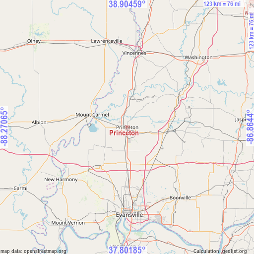
Princeton GPS coordinates[2]
38° 21' 19.152" North, 87° 34' 3.072" West
| Map corner | latitude | longitude |
|---|---|---|
| Upper-left | 38.90459°, | -88.27065° |
| Center: | 38.35532°, | -87.56752° |
| Lower-right: | 37.80185°, | -86.8644° |
| Map W x H: | 122.6×122.6 km | = 76.2×76.2mi |
| max Lat: | 71.29058° ⇑59.6% North |
| Princeton: | 38.35532° |
| min Lat: | ⇓40.4% South 19.06759° |
| min Long | Princeton | max Long |
| -171.73463° | -87.56752° | -66.98998° |
| W 49.1%⇐ | ⇒50.9% E |
Elevation
Elevation of Princeton is 152 m = 499 ft, and this is 142.8 m = 469 ft below average elevation for this country.
| Max E: |
3189 m = 10463 ft | 60.5% |
| Avg. | 294.8 m = 967 ft | |
| Princeton | 152 m = 499 ft | |
Min E: |
-60 m = -197 ft | 39.5% |
See also: United States elevation on elevation.city.
Geographical zone
Princeton is located in North temperate zone (between Tropic of Cancer and the Arctic Circle). Distance of this Northern Tropic circle is 1658.8 km =1030.7 mi to South.| Distance of | km | miles | from Princeton |
|---|---|---|---|
| North Pole | 5742.4 | 3568.2 | to North |
| Arctic Circle | 3136.5 | 1948.9 | to North |
| Tropic Cancer | 1658.8 | 1030.7 | to South |
| Equator | 4264.7 | 2650 | to South |


Nearby cities:
15 places around Princeton: (largest is in red/bold)
• Cynthiana
22.4 km =13.9 mi,  213°
213°
• Darmstadt
28.5 km =17.7 mi,  182°
182°
• Elberfeld
24.1 km =15 mi,  154°
154°
• Fort Branch
11.6 km =7.2 mi,  185°
185°
• Haubstadt
16.7 km =10.4 mi, 181°
• Lynnville
29.5 km =18.3 mi,  126°
126°
• Monroe City
34.3 km =21.3 mi,  32°
32°
• Mount Carmel
18 km =11.2 mi,  290°
290°
• Oakland City
19.5 km =12.1 mi,  95°
95°
• Owensville
14 km =8.7 mi,  228°
228°
• Patoka
6 km =3.7 mi,  344°
344°
• Petersburg
29.4 km =18.3 mi,  58°
58°
• Poseyville
27.9 km =17.3 mi,  222°
222°
• Saint Francisville
27.1 km =16.8 mi,  345°
345°
• Winslow
31.1 km =19.3 mi,  84°
84°
Sources, notices
• [Note1] Compared only with cities in United States existing in our database
• [Src1] Map data: © OpenStreetMap contributors (CC-BY-SA)
• [Src2] Other city data from geonames.org with taken over terms of usage.
• [Src3] Geographical zone / Annual Mean Temperature by Robert A. Rohde @ Wikipedia
