Irvine geodata
Irvine (Kentucky) is a seat of a second-order administrative division; located in United States in America/New_York (GMT-4) time zone. With population of 2,416 people, there are 10811 cities with bigger population in this country. Compared to other cities in United States, 63.2% of cities are located further ↑North; 59.3% of cities are located further ←West and 52.5% of cities have lower elevation than Irvine. Note1


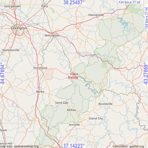
Irvine GPS coordinates[2]
37° 42' 2.304" North, 83° 58' 25.716" West
| Map corner | latitude | longitude |
|---|---|---|
| Upper-left | 38.25487°, | -84.67694° |
| Center: | 37.70064°, | -83.97381° |
| Lower-right: | 37.14223°, | -83.27069° |
| Map W x H: | 123.7×123.7 km | = 76.9×76.9mi |
| max Lat: | 71.29058° ⇑63.2% North |
| Irvine: | 37.70064° |
| min Lat: | ⇓36.8% South 19.06759° |
| min Long | Irvine | max Long |
| -171.73463° | -83.97381° | -66.98998° |
| W 59.3%⇐ | ⇒40.7% E |
Elevation
Elevation of Irvine is 208 m = 682 ft, and this is 86.8 m = 285 ft below average elevation for this country.
| Max E: |
3189 m = 10463 ft | 47.5% |
| Avg. | 294.8 m = 967 ft | |
| Irvine | 208 m = 682 ft | |
Min E: |
-60 m = -197 ft | 52.5% |
See also: United States elevation on elevation.city.
Geographical zone
Irvine is located in North temperate zone (between Tropic of Cancer and the Arctic Circle). Distance of this Northern Tropic circle is 1586 km =985.5 mi to South.| Distance of | km | miles | from Irvine |
|---|---|---|---|
| North Pole | 5815.1 | 3613.3 | to North |
| Arctic Circle | 3209.3 | 1994.2 | to North |
| Tropic Cancer | 1586 | 985.5 | to South |
| Equator | 4191.9 | 2604.7 | to South |


Nearby cities:
15 places around Irvine: (largest is in red/bold)
• Annville
42.4 km =26.3 mi,  179°
179°
• Beattyville
27.5 km =17.1 mi,  121°
121°
• Berea
32 km =19.9 mi,  242°
242°
• Booneville
36.3 km =22.6 mi,  133°
133°
• Camargo
33.5 km =20.8 mi,  13°
13°
• Campton
37.7 km =23.4 mi,  84°
84°
• Clay City
18.3 km =11.4 mi,  15°
15°
• Frenchburg
41.3 km =25.7 mi,  47°
47°
• Jeffersonville
32.5 km =20.2 mi, 20°
• McKee
30.1 km =18.7 mi, 184°
• Mount Sterling
39.7 km =24.7 mi,  3°
3°
• Ravenna
2.6 km =1.6 mi, 134°
• Richmond
28.7 km =17.8 mi,  280°
280°
• Stanton
19.1 km =11.9 mi,  32°
32°
• Winchester
36.9 km =22.9 mi,  330°
330°
Sources, notices
• [Note1] Compared only with cities in United States existing in our database
• [Src1] Map data: © OpenStreetMap contributors (CC-BY-SA)
• [Src2] Other city data from geonames.org with taken over terms of usage.
• [Src3] Geographical zone / Annual Mean Temperature by Robert A. Rohde @ Wikipedia
