Meads geodata
Meads (Kentucky) is a populated place; located in United States in America/New_York (GMT-4) time zone. With population of 288,649 people, there are 72 cities with bigger population in this country. Compared to other cities in United States, 59.3% of cities are located further ↑North; 62.9% of cities are located further ←West and 52.8% of cities have higher elevation than Meads. Note1


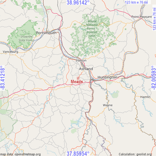
Meads GPS coordinates[2]
38° 24' 45.288" North, 82° 42' 32.58" West
| Map corner | latitude | longitude |
|---|---|---|
| Upper-left | 38.96142°, | -83.41218° |
| Center: | 38.41258°, | -82.70905° |
| Lower-right: | 37.85954°, | -82.00593° |
| Map W x H: | 122.5×122.5 km | = 76.1×76.1mi |
| max Lat: | 71.29058° ⇑59.3% North |
| Meads: | 38.41258° |
| min Lat: | ⇓40.7% South 19.06759° |
| min Long | Meads | max Long |
| -171.73463° | -82.70905° | -66.98998° |
| W 62.9%⇐ | ⇒37.1% E |
Elevation
Elevation of Meads is 188 m = 617 ft, and this is 106.8 m = 350 ft below average elevation for this country.
| Max E: |
3189 m = 10463 ft | 52.8% |
| Avg. | 294.8 m = 967 ft | |
| Meads | 188 m = 617 ft | |
Min E: |
-60 m = -197 ft | 47.2% |
See also: Meads elevation on elevation.city.
Geographical zone
Meads is located in North temperate zone (between Tropic of Cancer and the Arctic Circle). Distance of this Northern Tropic circle is 1665.2 km =1034.7 mi to South.| Distance of | km | miles | from Meads |
|---|---|---|---|
| North Pole | 5736 | 3564.2 | to North |
| Arctic Circle | 3130.1 | 1945 | to North |
| Tropic Cancer | 1665.2 | 1034.7 | to South |
| Equator | 4271.1 | 2653.9 | to South |


Nearby cities:
15 places around Meads: (largest is in red/bold)
• Ashland
9.6 km =6 mi,  40°
40°
• Bellefonte
9 km =5.6 mi,  10°
10°
• Burlington
15.1 km =9.4 mi,  92°
92°
• Cannonsburg
2.7 km =1.7 mi,  168°
168°
• Catlettsburg
9.5 km =5.9 mi,  95°
95°
• Ceredo
13.2 km =8.2 mi, 97°
• Coal Grove
11.4 km =7.1 mi,  28°
28°
• Flatwoods
12.3 km =7.6 mi,  356°
356°
• Ironton
14 km =8.7 mi, 9°
• Ironville
5.1 km =3.2 mi,  16°
16°
• Kenova
11.5 km =7.1 mi, 97°
• Raceland
14.3 km =8.9 mi,  353°
353°
• Russell
11.7 km =7.3 mi,  4°
4°
• South Point
10.7 km =6.6 mi, 86°
• Westwood
8.6 km =5.3 mi, 23°
Sources, notices
• [Note1] Compared only with cities in United States existing in our database
• [Src1] Map data: © OpenStreetMap contributors (CC-BY-SA)
• [Src2] Other city data from geonames.org with taken over terms of usage.
• [Src3] Geographical zone / Annual Mean Temperature by Robert A. Rohde @ Wikipedia
