Pikeville geodata
Pikeville (Kentucky) is a seat of a second-order administrative division; located in United States in America/New_York (GMT-4) time zone. With population of 7,012 people, there are 5807 cities with bigger population in this country. Compared to other cities in United States, 64.1% of cities are located further ↑North; 63.7% of cities are located further ←West and 52.8% of cities have lower elevation than Pikeville. Note1


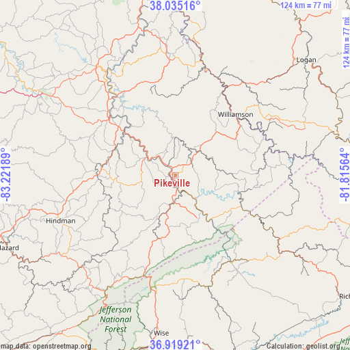
Pikeville GPS coordinates[2]
37° 28' 45.372" North, 82° 31' 7.536" West
| Map corner | latitude | longitude |
|---|---|---|
| Upper-left | 38.03516°, | -83.22189° |
| Center: | 37.47927°, | -82.51876° |
| Lower-right: | 36.91921°, | -81.81564° |
| Map W x H: | 124.1×124.1 km | = 77.1×77.1mi |
| max Lat: | 71.29058° ⇑64.1% North |
| Pikeville: | 37.47927° |
| min Lat: | ⇓35.9% South 19.06759° |
| min Long | Pikeville | max Long |
| -171.73463° | -82.51876° | -66.98998° |
| W 63.7%⇐ | ⇒36.3% E |
Elevation
Elevation of Pikeville is 209 m = 686 ft, and this is 85.8 m = 281 ft below average elevation for this country.
| Max E: |
3189 m = 10463 ft | 47.2% |
| Avg. | 294.8 m = 967 ft | |
| Pikeville | 209 m = 686 ft | |
Min E: |
-60 m = -197 ft | 52.8% |
See also: United States elevation on elevation.city.
Geographical zone
Pikeville is located in North temperate zone (between Tropic of Cancer and the Arctic Circle). Distance of this Northern Tropic circle is 1561.4 km =970.2 mi to South.| Distance of | km | miles | from Pikeville |
|---|---|---|---|
| North Pole | 5839.8 | 3628.7 | to North |
| Arctic Circle | 3233.9 | 2009.5 | to North |
| Tropic Cancer | 1561.4 | 970.2 | to South |
| Equator | 4167.3 | 2589.4 | to South |


Nearby cities:
15 places around Pikeville: (largest is in red/bold)
• Auxier
35.6 km =22.1 mi,  323°
323°
• Betsy Layne
12.9 km =8 mi,  308°
308°
• Chattaroy
32.6 km =20.3 mi,  40°
40°
• Coal Run Village
5.1 km =3.2 mi, 317°
• Elkhorn City
24.5 km =15.2 mi,  142°
142°
• Fleming-Neon
35.9 km =22.3 mi,  207°
207°
• Jenkins
35.4 km =22 mi,  196°
196°
• Martin
23.1 km =14.4 mi,  296°
296°
• McRoberts
33.1 km =20.6 mi, 204°
• Phelps
32.7 km =20.3 mi,  83°
83°
• Pippa Passes
35.3 km =21.9 mi,  242°
242°
• Prestonsburg
30.4 km =18.9 mi, 312°
• South Williamson
29.8 km =18.5 mi, 43°
• Wheelwright
24.2 km =15 mi,  227°
227°
• Williamson
30.4 km =18.9 mi, 44°
Sources, notices
• [Note1] Compared only with cities in United States existing in our database
• [Src1] Map data: © OpenStreetMap contributors (CC-BY-SA)
• [Src2] Other city data from geonames.org with taken over terms of usage.
• [Src3] Geographical zone / Annual Mean Temperature by Robert A. Rohde @ Wikipedia
