Chattaroy geodata
Chattaroy (West Virginia) is a populated place; located in United States in America/New_York (GMT-4) time zone. With population of 756 people, there are 18168 cities with bigger population in this country. Compared to other cities in United States, 63.2% of cities are located further ↑North; 64.7% of cities are located further ←West and 54.4% of cities have lower elevation than Chattaroy. Note1


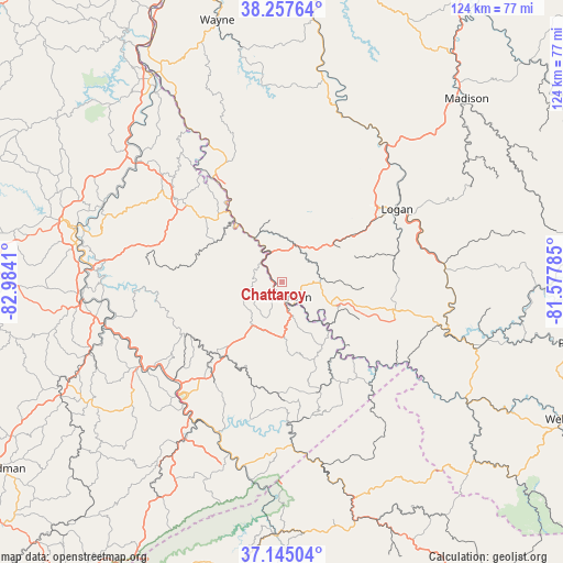
Chattaroy GPS coordinates[2]
37° 42' 12.348" North, 82° 16' 51.492" West
| Map corner | latitude | longitude |
|---|---|---|
| Upper-left | 38.25764°, | -82.9841° |
| Center: | 37.70343°, | -82.28097° |
| Lower-right: | 37.14504°, | -81.57785° |
| Map W x H: | 123.7×123.7 km | = 76.9×76.9mi |
| max Lat: | 71.29058° ⇑63.2% North |
| Chattaroy: | 37.70343° |
| min Lat: | ⇓36.8% South 19.06759° |
| min Long | Chattaroy | max Long |
| -171.73463° | -82.28097° | -66.98998° |
| W 64.7%⇐ | ⇒35.3% E |
Elevation
Elevation of Chattaroy is 216 m = 709 ft, and this is 78.8 m = 259 ft below average elevation for this country.
| Max E: |
3189 m = 10463 ft | 45.6% |
| Avg. | 294.8 m = 967 ft | |
| Chattaroy | 216 m = 709 ft | |
Min E: |
-60 m = -197 ft | 54.4% |
See also: United States elevation on elevation.city.
Geographical zone
Chattaroy is located in North temperate zone (between Tropic of Cancer and the Arctic Circle). Distance of this Northern Tropic circle is 1586.3 km =985.7 mi to South.| Distance of | km | miles | from Chattaroy |
|---|---|---|---|
| North Pole | 5814.8 | 3613.1 | to North |
| Arctic Circle | 3208.9 | 1993.9 | to North |
| Tropic Cancer | 1586.3 | 985.7 | to South |
| Equator | 4192.2 | 2604.9 | to South |


Nearby cities:
15 places around Chattaroy: (largest is in red/bold)
• Coal Run Village
32.3 km =20.1 mi,  229°
229°
• Delbarton
8.6 km =5.3 mi,  84°
84°
• Holden
23.6 km =14.7 mi,  55°
55°
• Inez
29 km =18 mi,  308°
308°
• Logan
30 km =18.6 mi, 57°
• McConnell
30.8 km =19.1 mi, 63°
• Mount Gay-Shamrock
26.7 km =16.6 mi, 55°
• Omar
25.4 km =15.8 mi, 76°
• Phelps
24.1 km =15 mi,  151°
151°
• Pikeville
32.6 km =20.3 mi,  220°
220°
• Red Jacket
13.8 km =8.6 mi,  116°
116°
• South Williamson
3.5 km =2.2 mi,  184°
184°
• Switzer
27.7 km =17.2 mi,  68°
68°
• Verdunville
25.3 km =15.7 mi,  51°
51°
• Williamson
3.3 km =2.1 mi,  174°
174°
Sources, notices
• [Note1] Compared only with cities in United States existing in our database
• [Src1] Map data: © OpenStreetMap contributors (CC-BY-SA)
• [Src2] Other city data from geonames.org with taken over terms of usage.
• [Src3] Geographical zone / Annual Mean Temperature by Robert A. Rohde @ Wikipedia
