Greenwood geodata
Greenwood (Louisiana) is a populated place; located in United States in America/Chicago (GMT-5) time zone. With population of 2,508 people, there are 10593 cities with bigger population in this country. Compared to other cities in United States, 91.7% of cities are located further ↑North; 62.3% of cities are located further →East and 87.4% of cities have higher elevation than Greenwood. Note1


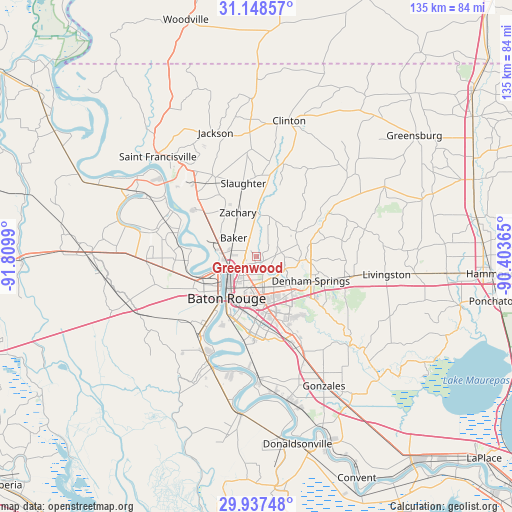
Greenwood GPS coordinates[2]
30° 32' 41.676" North, 91° 6' 24.372" West
| Map corner | latitude | longitude |
|---|---|---|
| Upper-left | 31.14857°, | -91.8099° |
| Center: | 30.54491°, | -91.10677° |
| Lower-right: | 29.93748°, | -90.40365° |
| Map W x H: | 134.7×134.7 km | = 83.7×83.7mi |
| max Lat: | 71.29058° ⇑91.7% North |
| Greenwood: | 30.54491° |
| min Lat: | ⇓8.3% South 19.06759° |
| min Long | Greenwood | max Long |
| -171.73463° | -91.10677° | -66.98998° |
| W 37.7%⇐ | ⇒62.3% E |
Elevation
Elevation of Greenwood is 22 m = 72 ft, and this is 272.8 m = 895 ft below average elevation for this country.
| Max E: |
3189 m = 10463 ft | 87.4% |
| Avg. | 294.8 m = 967 ft | |
| Greenwood | 22 m = 72 ft | |
Min E: |
-60 m = -197 ft | 12.6% |
See also: United States elevation on elevation.city.
Geographical zone
Greenwood is located in North temperate zone (between Tropic of Cancer and the Arctic Circle). Distance of this Northern Tropic circle is 790.4 km =491.1 mi to South.| Distance of | km | miles | from Greenwood |
|---|---|---|---|
| North Pole | 6610.8 | 4107.8 | to North |
| Arctic Circle | 4004.9 | 2488.5 | to North |
| Tropic Cancer | 790.4 | 491.1 | to South |
| Equator | 3396.3 | 2110.4 | to South |


Nearby cities:
15 places around Greenwood: (largest is in red/bold)
• Baker
7.6 km =4.7 mi,  309°
309°
• Baton Rouge
13.7 km =8.5 mi,  214°
214°
• Brownsfield
1.3 km =0.8 mi,  277°
277°
• Central
6.8 km =4.2 mi,  81°
81°
• Denham Springs
15.7 km =9.8 mi,  114°
114°
• Inniswold
15.7 km =9.8 mi,  171°
171°
• Merrydale
4.9 km =3 mi,  181°
181°
• Monticello
8.3 km =5.2 mi,  138°
138°
• Old Jefferson
20 km =12.4 mi,  154°
154°
• Port Allen
14.3 km =8.9 mi,  223°
223°
• Shenandoah
18.9 km =11.7 mi, 147°
• Slaughter
19.5 km =12.1 mi,  350°
350°
• Watson
15.1 km =9.4 mi, 76°
• Westminster
14.7 km =9.1 mi, 172°
• Zachary
12.5 km =7.8 mi,  337°
337°
Sources, notices
• [Note1] Compared only with cities in United States existing in our database
• [Src1] Map data: © OpenStreetMap contributors (CC-BY-SA)
• [Src2] Other city data from geonames.org with taken over terms of usage.
• [Src3] Geographical zone / Annual Mean Temperature by Robert A. Rohde @ Wikipedia
