Gueydan geodata
Gueydan (Louisiana) is a populated place; located in United States in America/Chicago (GMT-5) time zone. With population of 1,396 people, there are 14129 cities with bigger population in this country. Compared to other cities in United States, 93.3% of cities are located further ↑North; 65.2% of cities are located further →East and 95.7% of cities have higher elevation than Gueydan. Note1


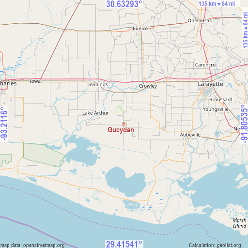
Gueydan GPS coordinates[2]
30° 1' 33.744" North, 92° 30' 30.492" West
| Map corner | latitude | longitude |
|---|---|---|
| Upper-left | 30.63293°, | -93.2116° |
| Center: | 30.02604°, | -92.50847° |
| Lower-right: | 29.41541°, | -91.80535° |
| Map W x H: | 135.4×135.4 km | = 84.1×84.1mi |
| max Lat: | 71.29058° ⇑93.3% North |
| Gueydan: | 30.02604° |
| min Lat: | ⇓6.7% South 19.06759° |
| min Long | Gueydan | max Long |
| -171.73463° | -92.50847° | -66.98998° |
| W 34.8%⇐ | ⇒65.2% E |
Elevation
Elevation of Gueydan is 8 m = 26 ft, and this is 286.8 m = 941 ft below average elevation for this country.
| Max E: |
3189 m = 10463 ft | 95.7% |
| Avg. | 294.8 m = 967 ft | |
| Gueydan | 8 m = 26 ft | |
Min E: |
-60 m = -197 ft | 4.3% |
See also: United States elevation on elevation.city.
Geographical zone
Gueydan is located in North temperate zone (between Tropic of Cancer and the Arctic Circle). Distance of this Northern Tropic circle is 732.7 km =455.3 mi to South.| Distance of | km | miles | from Gueydan |
|---|---|---|---|
| North Pole | 6668.5 | 4143.6 | to North |
| Arctic Circle | 4062.6 | 2524.4 | to North |
| Tropic Cancer | 732.7 | 455.3 | to South |
| Equator | 3338.6 | 2074.5 | to South |


Nearby cities:
15 places around Gueydan: (largest is in red/bold)
• Abbeville
36.5 km =22.7 mi,  99°
99°
• Crowley
24.6 km =15.3 mi,  31°
31°
• Duson
38.8 km =24.1 mi,  53°
53°
• Egan
23.4 km =14.5 mi,  0°
0°
• Estherwood
17.7 km =11 mi,  13°
13°
• Iota
34 km =21.1 mi, 2°
• Jennings
26.1 km =16.2 mi,  326°
326°
• Kaplan
21.8 km =13.5 mi, 98°
• Lake Arthur
16.8 km =10.4 mi,  291°
291°
• Maurice
38.1 km =23.7 mi,  76°
76°
• Mermentau
19.6 km =12.2 mi,  338°
338°
• Morse
10.7 km =6.6 mi, 5°
• Rayne
32.7 km =20.3 mi,  44°
44°
• Roanoke
32.8 km =20.4 mi,  315°
315°
• Welsh
38.2 km =23.7 mi,  307°
307°
Sources, notices
• [Note1] Compared only with cities in United States existing in our database
• [Src1] Map data: © OpenStreetMap contributors (CC-BY-SA)
• [Src2] Other city data from geonames.org with taken over terms of usage.
• [Src3] Geographical zone / Annual Mean Temperature by Robert A. Rohde @ Wikipedia
