Dundalk geodata
Dundalk (Maryland) is a populated place; located in United States in America/New_York (GMT-4) time zone. With population of 63,597 people, there are 685 cities with bigger population in this country. Compared to other cities in United States, 52.6% of cities are located further ↑North; 82.5% of cities are located further ←West and 93.9% of cities have higher elevation than Dundalk. Note1


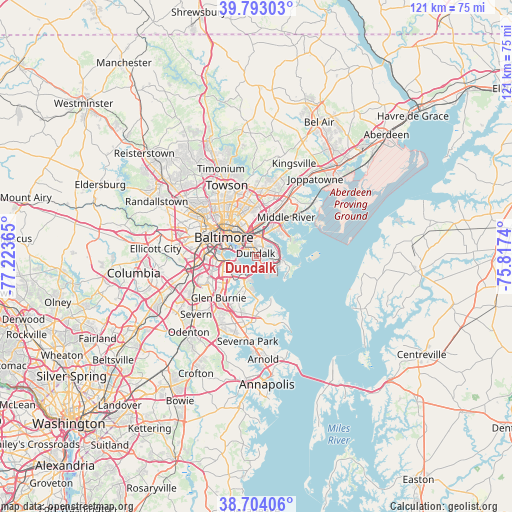
Dundalk GPS coordinates[2]
39° 15' 2.376" North, 76° 31' 13.872" West
| Map corner | latitude | longitude |
|---|---|---|
| Upper-left | 39.79303°, | -77.22365° |
| Center: | 39.25066°, | -76.52052° |
| Lower-right: | 38.70406°, | -75.8174° |
| Map W x H: | 121.1×121.1 km | = 75.2×75.2mi |
| max Lat: | 71.29058° ⇑52.6% North |
| Dundalk: | 39.25066° |
| min Lat: | ⇓47.4% South 19.06759° |
| min Long | Dundalk | max Long |
| -171.73463° | -76.52052° | -66.98998° |
| W 82.5%⇐ | ⇒17.5% E |
Elevation
Elevation of Dundalk is 10 m = 33 ft, and this is 284.8 m = 934 ft below average elevation for this country.
| Max E: |
3189 m = 10463 ft | 93.9% |
| Avg. | 294.8 m = 967 ft | |
| Dundalk | 10 m = 33 ft | |
Min E: |
-60 m = -197 ft | 6.1% |
See also: Dundalk elevation on elevation.city.
Geographical zone
Dundalk is located in North temperate zone (between Tropic of Cancer and the Arctic Circle). Distance of this Northern Tropic circle is 1758.3 km =1092.6 mi to South.| Distance of | km | miles | from Dundalk |
|---|---|---|---|
| North Pole | 5642.8 | 3506.3 | to North |
| Arctic Circle | 3036.9 | 1887 | to North |
| Tropic Cancer | 1758.3 | 1092.6 | to South |
| Equator | 4364.3 | 2711.8 | to South |


Nearby cities:
15 places around Dundalk: (largest is in red/bold)
• Baltimore
9 km =5.6 mi,  299°
299°
• Baltimore Highlands
10.2 km =6.3 mi,  258°
258°
• Brooklyn Park
8.6 km =5.3 mi,  253°
253°
• Butcher's Hill
7.3 km =4.5 mi,  306°
306°
• Charles Village
11.3 km =7 mi,  315°
315°
• Edgemere
6.3 km =3.9 mi,  98°
98°
• Essex
7.6 km =4.7 mi,  31°
31°
• Lansdowne
12.1 km =7.5 mi,  267°
267°
• Middle River
11.6 km =7.2 mi,  36°
36°
• Mount Vernon
9.7 km =6 mi, 302°
• Overlea
12.5 km =7.8 mi,  0°
0°
• Pumphrey
10.7 km =6.6 mi, 249°
• Riviera Beach
9.4 km =5.8 mi,  173°
173°
• Rosedale
7.7 km =4.8 mi, 3°
• Rossville
10.4 km =6.5 mi,  19°
19°
Sources, notices
• [Note1] Compared only with cities in United States existing in our database
• [Src1] Map data: © OpenStreetMap contributors (CC-BY-SA)
• [Src2] Other city data from geonames.org with taken over terms of usage.
• [Src3] Geographical zone / Annual Mean Temperature by Robert A. Rohde @ Wikipedia
