Grasonville geodata
Grasonville (Maryland) is a populated place; located in United States in America/New_York (GMT-4) time zone. With population of 3,425 people, there are 8953 cities with bigger population in this country. Compared to other cities in United States, 55.3% of cities are located further ↑North; 83.4% of cities are located further ←West and 98.8% of cities have higher elevation than Grasonville. Note1


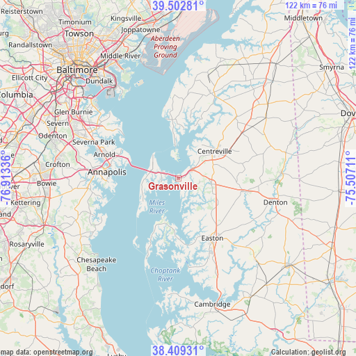
Grasonville GPS coordinates[2]
38° 57' 29.412" North, 76° 12' 36.828" West
| Map corner | latitude | longitude |
|---|---|---|
| Upper-left | 39.50281°, | -76.91336° |
| Center: | 38.95817°, | -76.21023° |
| Lower-right: | 38.40931°, | -75.50711° |
| Map W x H: | 121.6×121.6 km | = 75.6×75.6mi |
| max Lat: | 71.29058° ⇑55.3% North |
| Grasonville: | 38.95817° |
| min Lat: | ⇓44.7% South 19.06759° |
| min Long | Grasonville | max Long |
| -171.73463° | -76.21023° | -66.98998° |
| W 83.4%⇐ | ⇒16.6% E |
Elevation
Elevation of Grasonville is 4 m = 13 ft, and this is 290.8 m = 954 ft below average elevation for this country.
| Max E: |
3189 m = 10463 ft | 98.8% |
| Avg. | 294.8 m = 967 ft | |
| Grasonville | 4 m = 13 ft | |
Min E: |
-60 m = -197 ft | 1.2% |
See also: United States elevation on elevation.city.
Geographical zone
Grasonville is located in North temperate zone (between Tropic of Cancer and the Arctic Circle). Distance of this Northern Tropic circle is 1725.8 km =1072.4 mi to South.| Distance of | km | miles | from Grasonville |
|---|---|---|---|
| North Pole | 5675.3 | 3526.5 | to North |
| Arctic Circle | 3069.4 | 1907.2 | to North |
| Tropic Cancer | 1725.8 | 1072.4 | to South |
| Equator | 4331.7 | 2691.6 | to South |


Nearby cities:
15 places around Grasonville: (largest is in red/bold)
• Annapolis
24.5 km =15.2 mi,  275°
275°
• Arnold
26.6 km =16.5 mi,  288°
288°
• Cape Saint Claire
22.4 km =13.9 mi, 294°
• Centreville
15.5 km =9.6 mi,  53°
53°
• Chester
7.1 km =4.4 mi, 285°
• Cordova
20.7 km =12.9 mi,  116°
116°
• Easton
23.5 km =14.6 mi,  150°
150°
• Hillsmere Shores
24.7 km =15.3 mi,  265°
265°
• Kent Narrows
2.7 km =1.7 mi,  295°
295°
• Naval Academy
24.2 km =15 mi, 277°
• Queenstown
5.8 km =3.6 mi, 51°
• Robinwood
26.3 km =16.3 mi, 269°
• Rock Hall
20.1 km =12.5 mi,  353°
353°
• Saint Michaels
19.3 km =12 mi,  183°
183°
• Stevensville
9.3 km =5.8 mi, 285°
Sources, notices
• [Note1] Compared only with cities in United States existing in our database
• [Src1] Map data: © OpenStreetMap contributors (CC-BY-SA)
• [Src2] Other city data from geonames.org with taken over terms of usage.
• [Src3] Geographical zone / Annual Mean Temperature by Robert A. Rohde @ Wikipedia
