Holden geodata
Holden (Missouri) is a populated place; located in United States in America/Chicago (GMT-5) time zone. With population of 2,263 people, there are 11182 cities with bigger population in this country. Compared to other cities in United States, 57.3% of cities are located further ↑North; 68.6% of cities are located further →East and 65.2% of cities have lower elevation than Holden. Note1


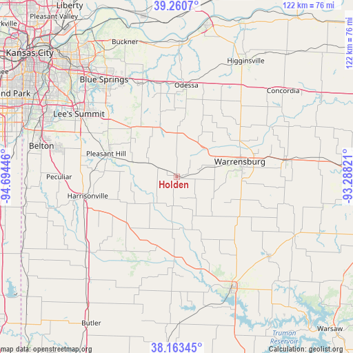
Holden GPS coordinates[2]
38° 42' 51.048" North, 93° 59' 28.788" West
| Map corner | latitude | longitude |
|---|---|---|
| Upper-left | 39.2607°, | -94.69446° |
| Center: | 38.71418°, | -93.99133° |
| Lower-right: | 38.16345°, | -93.28821° |
| Map W x H: | 122×122 km | = 75.8×75.8mi |
| max Lat: | 71.29058° ⇑57.3% North |
| Holden: | 38.71418° |
| min Lat: | ⇓42.7% South 19.06759° |
| min Long | Holden | max Long |
| -171.73463° | -93.99133° | -66.98998° |
| W 31.4%⇐ | ⇒68.6% E |
Elevation
Elevation of Holden is 263 m = 863 ft, and this is 31.8 m = 104 ft below average elevation for this country.
| Max E: |
3189 m = 10463 ft | 34.8% |
| Avg. | 294.8 m = 967 ft | |
| Holden | 263 m = 863 ft | |
Min E: |
-60 m = -197 ft | 65.2% |
See also: United States elevation on elevation.city.
Geographical zone
Holden is located in North temperate zone (between Tropic of Cancer and the Arctic Circle). Distance of this Northern Tropic circle is 1698.7 km =1055.5 mi to South.| Distance of | km | miles | from Holden |
|---|---|---|---|
| North Pole | 5702.4 | 3543.3 | to North |
| Arctic Circle | 3096.6 | 1924.1 | to North |
| Tropic Cancer | 1698.7 | 1055.5 | to South |
| Equator | 4304.6 | 2674.8 | to South |


Nearby cities:
15 places around Holden: (largest is in red/bold)
• Garden City
24.3 km =15.1 mi,  225°
225°
• Grain Valley
38 km =23.6 mi,  331°
331°
• Greenwood
34.2 km =21.3 mi,  296°
296°
• Harrisonville
31.8 km =19.8 mi,  257°
257°
• Knob Noster
38 km =23.6 mi,  81°
81°
• Lake Lotawana
31.9 km =19.8 mi,  316°
316°
• Lake Winnebago
34.4 km =21.4 mi,  292°
292°
• Lee's Summit
40.3 km =25 mi, 302°
• Leeton
29.6 km =18.4 mi,  119°
119°
• Lone Jack
23.5 km =14.6 mi, 317°
• Oak Grove
34.5 km =21.4 mi,  339°
339°
• Odessa
31.9 km =19.8 mi,  5°
5°
• Pleasant Hill
25.5 km =15.8 mi, 288°
• Warrensburg
22.8 km =14.2 mi, 76°
• Whiteman Air Force Base
37.6 km =23.4 mi,  87°
87°
Sources, notices
• [Note1] Compared only with cities in United States existing in our database
• [Src1] Map data: © OpenStreetMap contributors (CC-BY-SA)
• [Src2] Other city data from geonames.org with taken over terms of usage.
• [Src3] Geographical zone / Annual Mean Temperature by Robert A. Rohde @ Wikipedia
