Leadwood geodata
Leadwood (Missouri) is a populated place; located in United States in America/Chicago (GMT-5) time zone. With population of 1,236 people, there are 14921 cities with bigger population in this country. Compared to other cities in United States, 62.3% of cities are located further ↑North; 61.2% of cities are located further →East and 62.4% of cities have lower elevation than Leadwood. Note1
Administrative division(s):
- Level 1: Missouri
- Level 2: Saint Francois County
- Level 3: Township of Randolph


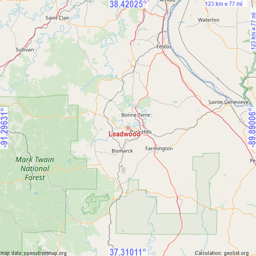
Leadwood GPS coordinates[2]
37° 52' 2.172" North, 90° 35' 35.448" West
| Map corner | latitude | longitude |
|---|---|---|
| Upper-left | 38.42025°, | -91.29631° |
| Center: | 37.86727°, | -90.59318° |
| Lower-right: | 37.31011°, | -89.89006° |
| Map W x H: | 123.4×123.4 km | = 76.7×76.7mi |
| max Lat: | 71.29058° ⇑62.3% North |
| Leadwood: | 37.86727° |
| min Lat: | ⇓37.7% South 19.06759° |
| min Long | Leadwood | max Long |
| -171.73463° | -90.59318° | -66.98998° |
| W 38.8%⇐ | ⇒61.2% E |
Elevation
Elevation of Leadwood is 250 m = 820 ft, and this is 44.8 m = 147 ft below average elevation for this country.
| Max E: |
3189 m = 10463 ft | 37.6% |
| Avg. | 294.8 m = 967 ft | |
| Leadwood | 250 m = 820 ft | |
Min E: |
-60 m = -197 ft | 62.4% |
See also: United States elevation on elevation.city.
Geographical zone
Leadwood is located in North temperate zone (between Tropic of Cancer and the Arctic Circle). Distance of this Northern Tropic circle is 1604.5 km =997 mi to South.| Distance of | km | miles | from Leadwood |
|---|---|---|---|
| North Pole | 5796.6 | 3601.8 | to North |
| Arctic Circle | 3190.7 | 1982.6 | to North |
| Tropic Cancer | 1604.5 | 997 | to South |
| Equator | 4210.4 | 2616.2 | to South |


Nearby cities:
15 places around Leadwood: (largest is in red/bold)
• Bismarck
11.3 km =7 mi,  194°
194°
• Bonne Terre
7 km =4.3 mi,  28°
28°
• De Soto
30.5 km =19 mi,  6°
6°
• Desloge
5.8 km =3.6 mi,  86°
86°
• Doe Run
16.2 km =10.1 mi,  148°
148°
• Elvins
6.3 km =3.9 mi,  122°
122°
• Esther
8.5 km =5.3 mi,  102°
102°
• Farmington
17.9 km =11.1 mi, 122°
• Flat River
7 km =4.3 mi,  105°
105°
• Iron Mountain Lake
19.5 km =12.1 mi, 187°
• Ironton
30.2 km =18.8 mi, 185°
• Park Hills
6.7 km =4.2 mi, 102°
• Pilot Knob
27.7 km =17.2 mi, 188°
• Potosi
18.7 km =11.6 mi,  294°
294°
• Terre du Lac
5.7 km =3.5 mi,  330°
330°
Sources, notices
• [Note1] Compared only with cities in United States existing in our database
• [Src1] Map data: © OpenStreetMap contributors (CC-BY-SA)
• [Src2] Other city data from geonames.org with taken over terms of usage.
• [Src3] Geographical zone / Annual Mean Temperature by Robert A. Rohde @ Wikipedia
