Caroleen geodata
Caroleen (North Carolina) is a populated place; located in United States in America/New_York (GMT-4) time zone. With population of 652 people, there are 19161 cities with bigger population in this country. Compared to other cities in United States, 73.8% of cities are located further ↑North; 66.3% of cities are located further ←West and 63.9% of cities have lower elevation than Caroleen. Note1
Administrative division(s):
- Level 1: North Carolina
- Level 2: Rutherford County
- Level 3: Township of High Shoals


Caroleen GPS coordinates[2]
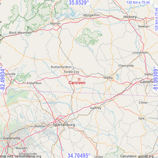
35° 16' 51.456" North, 81° 47' 46.356" West
| Map corner | latitude | longitude |
|---|---|---|
| Upper-left | 35.8529°, | -82.49934° |
| Center: | 35.28096°, | -81.79621° |
| Lower-right: | 34.70495°, | -81.09309° |
| Map W x H: | 127.6×127.6 km | = 79.3×79.3mi |
| max Lat: | 71.29058° ⇑73.8% North |
| Caroleen: | 35.28096° |
| min Lat: | ⇓26.2% South 19.06759° |
| min Long | Caroleen | max Long |
| -171.73463° | -81.79621° | -66.98998° |
| W 66.3%⇐ | ⇒33.7% E |
Elevation
Elevation of Caroleen is 257 m = 843 ft, and this is 37.8 m = 124 ft below average elevation for this country.
| Max E: |
3189 m = 10463 ft | 36.1% |
| Avg. | 294.8 m = 967 ft | |
| Caroleen | 257 m = 843 ft | |
Min E: |
-60 m = -197 ft | 63.9% |
See also: United States elevation on elevation.city.
Geographical zone
Caroleen is located in North temperate zone (between Tropic of Cancer and the Arctic Circle). Distance of this Northern Tropic circle is 1317 km =818.3 mi to South.| Distance of | km | miles | from Caroleen |
|---|---|---|---|
| North Pole | 6084.2 | 3780.5 | to North |
| Arctic Circle | 3478.3 | 2161.3 | to North |
| Tropic Cancer | 1317 | 818.3 | to South |
| Equator | 3922.9 | 2437.6 | to South |


Nearby cities:
15 places around Caroleen: (largest is in red/bold)
• Alexander Mills
6.6 km =4.1 mi,  300°
300°
• Boiling Springs
12.1 km =7.5 mi,  104°
104°
• Chesnee
15.9 km =9.9 mi,  201°
201°
• Cliffside
5.3 km =3.3 mi,  153°
153°
• East Gaffney
26.8 km =16.7 mi, 146°
• Ellenboro
6.3 km =3.9 mi,  32°
32°
• Forest City
8.6 km =5.3 mi,  313°
313°
• Kingstown
18.4 km =11.4 mi,  64°
64°
• Lawndale
25.8 km =16 mi, 55°
• Mayo
22.6 km =14 mi,  194°
194°
• Patterson Springs
26.1 km =16.2 mi, 101°
• Polkville
20.6 km =12.8 mi,  42°
42°
• Rutherfordton
17.6 km =10.9 mi, 303°
• Shelby
23.7 km =14.7 mi,  86°
86°
• Spindale
14.9 km =9.3 mi, 306°
Sources, notices
• [Note1] Compared only with cities in United States existing in our database
• [Src1] Map data: © OpenStreetMap contributors (CC-BY-SA)
• [Src2] Other city data from geonames.org with taken over terms of usage.
• [Src3] Geographical zone / Annual Mean Temperature by Robert A. Rohde @ Wikipedia
