East Gaffney geodata
East Gaffney (South Carolina) is a populated place; located in United States in America/New_York (GMT-4) time zone. With population of 3,085 people, there are 9489 cities with bigger population in this country. Compared to other cities in United States, 74.9% of cities are located further ↑North; 67% of cities are located further ←West and 59.9% of cities have lower elevation than East Gaffney. Note1


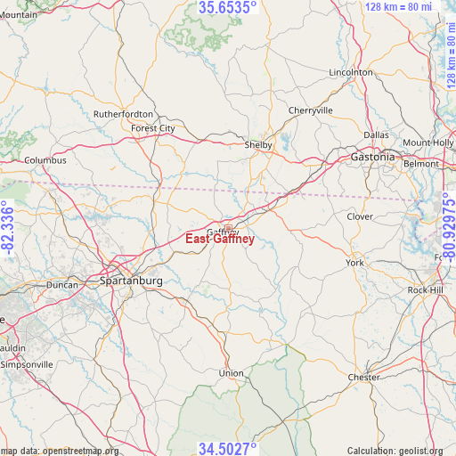
East Gaffney GPS coordinates[2]
35° 4' 48.468" North, 81° 37' 58.332" West
| Map corner | latitude | longitude |
|---|---|---|
| Upper-left | 35.6535°, | -82.336° |
| Center: | 35.08013°, | -81.63287° |
| Lower-right: | 34.5027°, | -80.92975° |
| Map W x H: | 128×128 km | = 79.5×79.5mi |
| max Lat: | 71.29058° ⇑74.9% North |
| East Gaffney: | 35.08013° |
| min Lat: | ⇓25.1% South 19.06759° |
| min Long | East Gaffney | max Long |
| -171.73463° | -81.63287° | -66.98998° |
| W 67%⇐ | ⇒33% E |
Elevation
Elevation of East Gaffney is 239 m = 784 ft, and this is 55.8 m = 183 ft below average elevation for this country.
| Max E: |
3189 m = 10463 ft | 40.1% |
| Avg. | 294.8 m = 967 ft | |
| East Gaffney | 239 m = 784 ft | |
Min E: |
-60 m = -197 ft | 59.9% |
See also: United States elevation on elevation.city.
Geographical zone
East Gaffney is located in North temperate zone (between Tropic of Cancer and the Arctic Circle). Distance of this Northern Tropic circle is 1294.6 km =804.4 mi to South.| Distance of | km | miles | from East Gaffney |
|---|---|---|---|
| North Pole | 6106.5 | 3794.4 | to North |
| Arctic Circle | 3500.6 | 2175.2 | to North |
| Tropic Cancer | 1294.6 | 804.4 | to South |
| Equator | 3900.5 | 2423.7 | to South |


Nearby cities:
15 places around East Gaffney: (largest is in red/bold)
• Blacksburg
11.6 km =7.2 mi,  66°
66°
• Boiling Springs
19.6 km =12.2 mi,  350°
350°
• Chesnee
22.1 km =13.7 mi,  290°
290°
• Cliffside
21.5 km =13.4 mi,  324°
324°
• Clifton
20.2 km =12.6 mi,  236°
236°
• Converse
20.8 km =12.9 mi, 241°
• Cowpens
17.1 km =10.6 mi,  245°
245°
• Gaffney
1.8 km =1.1 mi, 238°
• Grover
19.7 km =12.2 mi,  57°
57°
• Light Oak
26.8 km =16.7 mi,  31°
31°
• Mayo
20.7 km =12.9 mi,  271°
271°
• Pacolet
23.3 km =14.5 mi,  210°
210°
• Pacolet Mills
20.2 km =12.6 mi, 209°
• Patterson Springs
20.3 km =12.6 mi, 31°
• Shelby
25.2 km =15.7 mi,  20°
20°
Sources, notices
• [Note1] Compared only with cities in United States existing in our database
• [Src1] Map data: © OpenStreetMap contributors (CC-BY-SA)
• [Src2] Other city data from geonames.org with taken over terms of usage.
• [Src3] Geographical zone / Annual Mean Temperature by Robert A. Rohde @ Wikipedia
