Ellerbe geodata
Ellerbe (North Carolina) is a populated place; located in United States in America/New_York (GMT-4) time zone. With population of 1,005 people, there are 16252 cities with bigger population in this country. Compared to other cities in United States, 75% of cities are located further ↑North; 74.3% of cities are located further ←West and 58% of cities have higher elevation than Ellerbe. Note1
Administrative division(s):
- Level 1: North Carolina
- Level 2: Richmond County
- Level 3: Township of Mineral Springs


Ellerbe GPS coordinates[2]
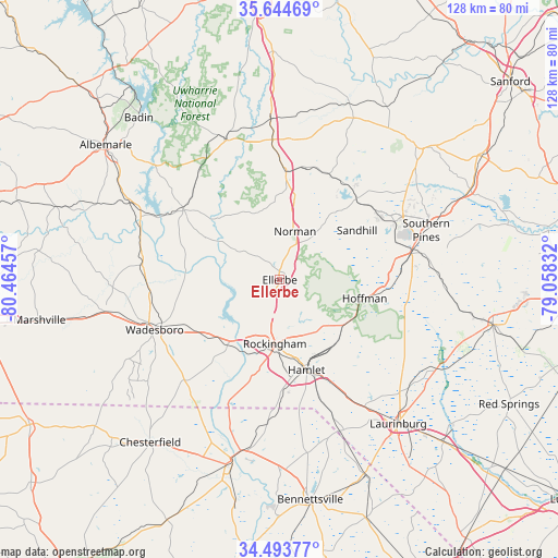
35° 4' 16.536" North, 79° 45' 41.184" West
| Map corner | latitude | longitude |
|---|---|---|
| Upper-left | 35.64469°, | -80.46457° |
| Center: | 35.07126°, | -79.76144° |
| Lower-right: | 34.49377°, | -79.05832° |
| Map W x H: | 128×128 km | = 79.5×79.5mi |
| max Lat: | 71.29058° ⇑75% North |
| Ellerbe: | 35.07126° |
| min Lat: | ⇓25% South 19.06759° |
| min Long | Ellerbe | max Long |
| -171.73463° | -79.76144° | -66.98998° |
| W 74.3%⇐ | ⇒25.7% E |
Elevation
Elevation of Ellerbe is 165 m = 541 ft, and this is 129.8 m = 426 ft below average elevation for this country.
| Max E: |
3189 m = 10463 ft | 58% |
| Avg. | 294.8 m = 967 ft | |
| Ellerbe | 165 m = 541 ft | |
Min E: |
-60 m = -197 ft | 42% |
See also: United States elevation on elevation.city.
Geographical zone
Ellerbe is located in North temperate zone (between Tropic of Cancer and the Arctic Circle). Distance of this Northern Tropic circle is 1293.6 km =803.8 mi to South.| Distance of | km | miles | from Ellerbe |
|---|---|---|---|
| North Pole | 6107.5 | 3795 | to North |
| Arctic Circle | 3501.6 | 2175.8 | to North |
| Tropic Cancer | 1293.6 | 803.8 | to South |
| Equator | 3899.6 | 2423.1 | to South |


Nearby cities:
15 places around Ellerbe: (largest is in red/bold)
• Aberdeen
30.9 km =19.2 mi,  77°
77°
• Candor
24.9 km =15.5 mi,  3°
3°
• Cordova
18.4 km =11.4 mi,  197°
197°
• Dobbins Heights
19.5 km =12.1 mi,  161°
161°
• East Rockingham
17 km =10.6 mi,  180°
180°
• Foxfire
20.8 km =12.9 mi,  56°
56°
• Hamlet
21.6 km =13.4 mi, 163°
• Hoffman
19.9 km =12.4 mi,  102°
102°
• Lilesville
23.4 km =14.5 mi,  240°
240°
• Mount Gilead
27.1 km =16.8 mi,  306°
306°
• Pinebluff
26.7 km =16.6 mi, 80°
• Pinehurst
29.9 km =18.6 mi, 62°
• Rockingham
14.7 km =9.1 mi, 184°
• Seven Lakes
29.2 km =18.1 mi,  37°
37°
• Taylortown
29.3 km =18.2 mi, 58°
Sources, notices
• [Note1] Compared only with cities in United States existing in our database
• [Src1] Map data: © OpenStreetMap contributors (CC-BY-SA)
• [Src2] Other city data from geonames.org with taken over terms of usage.
• [Src3] Geographical zone / Annual Mean Temperature by Robert A. Rohde @ Wikipedia
