Hoffman geodata
Hoffman (North Carolina) is a populated place; located in United States in America/New_York (GMT-4) time zone. With population of 572 people, there are 20007 cities with bigger population in this country. Compared to other cities in United States, 75.2% of cities are located further ↑North; 74.8% of cities are located further ←West and 64.7% of cities have higher elevation than Hoffman. Note1
Administrative division(s):
- Level 1: North Carolina
- Level 2: Richmond County
- Level 3: Township of Beaverdam


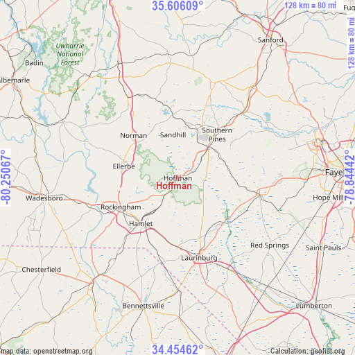
Hoffman GPS coordinates[2]
35° 1' 56.568" North, 79° 32' 51.144" West
| Map corner | latitude | longitude |
|---|---|---|
| Upper-left | 35.60609°, | -80.25067° |
| Center: | 35.03238°, | -79.54754° |
| Lower-right: | 34.45462°, | -78.84442° |
| Map W x H: | 128×128 km | = 79.5×79.5mi |
| max Lat: | 71.29058° ⇑75.2% North |
| Hoffman: | 35.03238° |
| min Lat: | ⇓24.8% South 19.06759° |
| min Long | Hoffman | max Long |
| -171.73463° | -79.54754° | -66.98998° |
| W 74.8%⇐ | ⇒25.2% E |
Elevation
Elevation of Hoffman is 130 m = 427 ft, and this is 164.8 m = 541 ft below average elevation for this country.
| Max E: |
3189 m = 10463 ft | 64.7% |
| Avg. | 294.8 m = 967 ft | |
| Hoffman | 130 m = 427 ft | |
Min E: |
-60 m = -197 ft | 35.3% |
See also: United States elevation on elevation.city.
Geographical zone
Hoffman is located in North temperate zone (between Tropic of Cancer and the Arctic Circle). Distance of this Northern Tropic circle is 1289.3 km =801.1 mi to South.| Distance of | km | miles | from Hoffman |
|---|---|---|---|
| North Pole | 6111.8 | 3797.7 | to North |
| Arctic Circle | 3505.9 | 2178.5 | to North |
| Tropic Cancer | 1289.3 | 801.1 | to South |
| Equator | 3895.2 | 2420.4 | to South |


Nearby cities:
15 places around Hoffman: (largest is in red/bold)
• Aberdeen
15.4 km =9.6 mi,  44°
44°
• Dobbins Heights
19.4 km =12.1 mi,  222°
222°
• East Rockingham
23.3 km =14.5 mi,  237°
237°
• Ellerbe
19.9 km =12.4 mi,  282°
282°
• Five Points
17.1 km =10.6 mi,  95°
95°
• Foxfire
16.1 km =10 mi,  352°
352°
• Hamlet
21.2 km =13.2 mi, 219°
• Laurel Hill
24.8 km =15.4 mi,  180°
180°
• Pinebluff
11 km =6.8 mi, 38°
• Pinehurst
19.5 km =12.1 mi,  21°
21°
• Rockingham
23.1 km =14.4 mi, 243°
• Seven Lakes
27.4 km =17 mi,  356°
356°
• Southern Pines
21.2 km =13.2 mi, 41°
• Taylortown
20.3 km =12.6 mi, 16°
• Wagram
23 km =14.3 mi,  134°
134°
Sources, notices
• [Note1] Compared only with cities in United States existing in our database
• [Src1] Map data: © OpenStreetMap contributors (CC-BY-SA)
• [Src2] Other city data from geonames.org with taken over terms of usage.
• [Src3] Geographical zone / Annual Mean Temperature by Robert A. Rohde @ Wikipedia
