Greensboro geodata
Greensboro (North Carolina) is a populated place; located in United States in America/New_York (GMT-4) time zone. With population of 285,342 people, there are 75 cities with bigger population in this country. Compared to other cities in United States, 70.1% of cities are located further ↑North; 74.2% of cities are located further ←West and 64.5% of cities have lower elevation than Greensboro. Note1
Administrative division(s):
- Level 1: North Carolina
- Level 2: Guilford County
- Level 3: Township of Morehead


Greensboro GPS coordinates[2]
36° 4' 21.504" North, 79° 47' 31.128" West
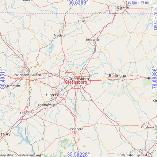
| Map corner | latitude | longitude |
|---|---|---|
| Upper-left | 36.6389°, | -80.49511° |
| Center: | 36.07264°, | -79.79198° |
| Lower-right: | 35.50228°, | -79.08886° |
| Map W x H: | 126.4×126.4 km | = 78.5×78.5mi |
| max Lat: | 71.29058° ⇑70.1% North |
| Greensboro: | 36.07264° |
| min Lat: | ⇓29.9% South 19.06759° |
| min Long | Greensboro | max Long |
| -171.73463° | -79.79198° | -66.98998° |
| W 74.2%⇐ | ⇒25.8% E |
Elevation
Elevation of Greensboro is 260 m = 853 ft, and this is 34.8 m = 114 ft below average elevation for this country.
| Max E: |
3189 m = 10463 ft | 35.5% |
| Avg. | 294.8 m = 967 ft | |
| Greensboro | 260 m = 853 ft | |
Min E: |
-60 m = -197 ft | 64.5% |
See also: Greensboro elevation on elevation.city.
Geographical zone
Greensboro is located in North temperate zone (between Tropic of Cancer and the Arctic Circle). Distance of this Northern Tropic circle is 1405 km =873 mi to South.| Distance of | km | miles | from Greensboro |
|---|---|---|---|
| North Pole | 5996.2 | 3725.9 | to North |
| Arctic Circle | 3390.3 | 2106.6 | to North |
| Tropic Cancer | 1405 | 873 | to South |
| Equator | 4010.9 | 2492.3 | to South |


Nearby cities:
15 places around Greensboro: (largest is in red/bold)
• Archdale
23.9 km =14.9 mi,  222°
222°
• Elon
25.9 km =16.1 mi,  82°
82°
• Forest Oaks
12.2 km =7.6 mi,  140°
140°
• Gibsonville
22.7 km =14.1 mi, 80°
• High Point
23.2 km =14.4 mi,  235°
235°
• Jamestown
15.6 km =9.7 mi, 235°
• Kernersville
25.8 km =16 mi,  281°
281°
• McLeansville
12.6 km =7.8 mi,  72°
72°
• Oak Ridge
20.9 km =13 mi,  302°
302°
• Pleasant Garden
12.6 km =7.8 mi,  167°
167°
• Sedalia
15.4 km =9.6 mi,  92°
92°
• Stokesdale
24.9 km =15.5 mi,  317°
317°
• Summerfield
18.2 km =11.3 mi,  326°
326°
• Trinity
26.7 km =16.6 mi, 222°
• Whitsett
20.4 km =12.7 mi, 90°
Sources, notices
• [Note1] Compared only with cities in United States existing in our database
• [Src1] Map data: © OpenStreetMap contributors (CC-BY-SA)
• [Src2] Other city data from geonames.org with taken over terms of usage.
• [Src3] Geographical zone / Annual Mean Temperature by Robert A. Rohde @ Wikipedia
