Pilot Mountain geodata
Pilot Mountain (North Carolina) is a populated place; located in United States in America/New_York (GMT-4) time zone. With population of 1,465 people, there are 13816 cities with bigger population in this country. Compared to other cities in United States, 68.5% of cities are located further ↑North; 70.9% of cities are located further ←West and 80% of cities have lower elevation than Pilot Mountain. Note1
Administrative division(s):
- Level 1: North Carolina
- Level 2: Surry County
- Level 3: Township of Pilot


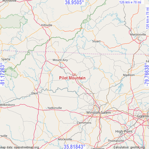
Pilot Mountain GPS coordinates[2]
36° 23' 11.508" North, 80° 28' 10.2" West
| Map corner | latitude | longitude |
|---|---|---|
| Upper-left | 36.9505°, | -81.17263° |
| Center: | 36.38653°, | -80.4695° |
| Lower-right: | 35.81843°, | -79.76638° |
| Map W x H: | 125.9×125.9 km | = 78.2×78.2mi |
| max Lat: | 71.29058° ⇑68.5% North |
| Pilot Mountain: | 36.38653° |
| min Lat: | ⇓31.5% South 19.06759° |
| min Long | Pilot Mountain | max Long |
| -171.73463° | -80.4695° | -66.98998° |
| W 70.9%⇐ | ⇒29.1% E |
Elevation
Elevation of Pilot Mountain is 353 m = 1158 ft, and this is 58.2 m = 191 ft above average elevation for this country.
| Max E: |
3189 m = 10463 ft | 20% |
| Pilot Mountain | 353 m 1158 ft | |
| Avg. | 294.8 m = 967 ft | |
Min E: |
-60 m = -197 ft | 80% |
See also: United States elevation on elevation.city.
Geographical zone
Pilot Mountain is located in North temperate zone (between Tropic of Cancer and the Arctic Circle). Distance of this Northern Tropic circle is 1439.9 km =894.7 mi to South.| Distance of | km | miles | from Pilot Mountain |
|---|---|---|---|
| North Pole | 5961.3 | 3704.2 | to North |
| Arctic Circle | 3355.4 | 2084.9 | to North |
| Tropic Cancer | 1439.9 | 894.7 | to South |
| Equator | 4045.8 | 2513.9 | to South |


Nearby cities:
15 places around Pilot Mountain: (largest is in red/bold)
• Boonville
27.4 km =17 mi,  231°
231°
• Cana
28.9 km =18 mi,  321°
321°
• Danbury
23.7 km =14.7 mi,  83°
83°
• Dobson
22.7 km =14.1 mi,  272°
272°
• East Bend
19.3 km =12 mi,  191°
191°
• Flat Rock
16.6 km =10.3 mi,  327°
327°
• Germanton
25.4 km =15.8 mi,  122°
122°
• King
15.4 km =9.6 mi,  139°
139°
• Mount Airy
17.6 km =10.9 mi, 315°
• Pinnacle
7.1 km =4.4 mi,  152°
152°
• Rural Hall
22.6 km =14 mi, 135°
• Toast
18.9 km =11.7 mi,  312°
312°
• Tobaccoville
18.7 km =11.6 mi, 151°
• Walnut Cove
31.1 km =19.3 mi,  109°
109°
• White Plains
16.1 km =10 mi,  294°
294°
Sources, notices
• [Note1] Compared only with cities in United States existing in our database
• [Src1] Map data: © OpenStreetMap contributors (CC-BY-SA)
• [Src2] Other city data from geonames.org with taken over terms of usage.
• [Src3] Geographical zone / Annual Mean Temperature by Robert A. Rohde @ Wikipedia
