Statesville geodata
Statesville (North Carolina) is a seat of a second-order administrative division; located in United States in America/New_York (GMT-4) time zone. With population of 26,221 people, there are 1913 cities with bigger population in this country. Compared to other cities in United States, 71.4% of cities are located further ↑North; 69.7% of cities are located further ←West and 69% of cities have lower elevation than Statesville. Note1
Administrative division(s):
- Level 1: North Carolina
- Level 2: Iredell County
- Level 3: Township of Statesville


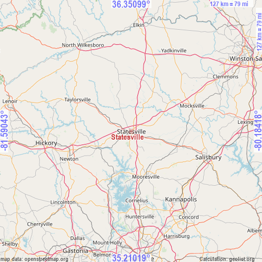
Statesville GPS coordinates[2]
35° 46' 57.504" North, 80° 53' 14.28" West
| Map corner | latitude | longitude |
|---|---|---|
| Upper-left | 36.35099°, | -81.59043° |
| Center: | 35.78264°, | -80.8873° |
| Lower-right: | 35.21019°, | -80.18418° |
| Map W x H: | 126.8×126.8 km | = 78.8×78.8mi |
| max Lat: | 71.29058° ⇑71.4% North |
| Statesville: | 35.78264° |
| min Lat: | ⇓28.6% South 19.06759° |
| min Long | Statesville | max Long |
| -171.73463° | -80.8873° | -66.98998° |
| W 69.7%⇐ | ⇒30.3% E |
Elevation
Elevation of Statesville is 281 m = 922 ft, and this is 13.8 m = 45 ft below average elevation for this country.
| Max E: |
3189 m = 10463 ft | 31% |
| Avg. | 294.8 m = 967 ft | |
| Statesville | 281 m = 922 ft | |
Min E: |
-60 m = -197 ft | 69% |
See also: United States elevation on elevation.city.
Geographical zone
Statesville is located in North temperate zone (between Tropic of Cancer and the Arctic Circle). Distance of this Northern Tropic circle is 1372.7 km =853 mi to South.| Distance of | km | miles | from Statesville |
|---|---|---|---|
| North Pole | 6028.4 | 3745.9 | to North |
| Arctic Circle | 3422.5 | 2126.6 | to North |
| Tropic Cancer | 1372.7 | 853 | to South |
| Equator | 3978.7 | 2472.2 | to South |


Nearby cities:
15 places around Statesville: (largest is in red/bold)
• Catawba
18.9 km =11.7 mi,  243°
243°
• Claremont
24.6 km =15.3 mi,  252°
252°
• Cleveland
19.8 km =12.3 mi,  106°
106°
• Conover
31.1 km =19.3 mi, 254°
• Cooleemee
30 km =18.6 mi,  84°
84°
• Davidson
31.5 km =19.6 mi,  172°
172°
• Denver
30.8 km =19.1 mi,  204°
204°
• Harmony
21.9 km =13.6 mi,  28°
28°
• Hiddenite
22.7 km =14.1 mi,  306°
306°
• Lake Norman of Catawba
22.7 km =14.1 mi, 196°
• Mooresville
23.1 km =14.4 mi,  162°
162°
• Sherrills Ford
20.1 km =12.5 mi,  206°
206°
• Stony Point
17 km =10.6 mi,  301°
301°
• Taylorsville
30.3 km =18.8 mi, 300°
• Troutman
9.1 km =5.7 mi,  180°
180°
Sources, notices
• [Note1] Compared only with cities in United States existing in our database
• [Src1] Map data: © OpenStreetMap contributors (CC-BY-SA)
• [Src2] Other city data from geonames.org with taken over terms of usage.
• [Src3] Geographical zone / Annual Mean Temperature by Robert A. Rohde @ Wikipedia
