Bridgeton geodata
Bridgeton (New Jersey) is a seat of a second-order administrative division; located in United States in America/New_York (GMT-4) time zone. With population of 25,031 people, there are 2001 cities with bigger population in this country. Compared to other cities in United States, 51.4% of cities are located further ↑North; 86.6% of cities are located further ←West and 98.8% of cities have higher elevation than Bridgeton. Note1
Administrative division(s):
- Level 1: New Jersey
- Level 2: Cumberland County
- Level 3: City of Bridgeton


Bridgeton GPS coordinates[2]
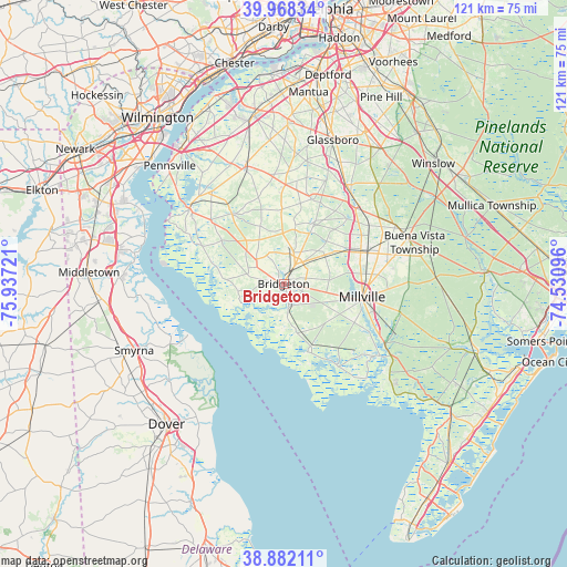
39° 25' 38.424" North, 75° 14' 2.688" West
| Map corner | latitude | longitude |
|---|---|---|
| Upper-left | 39.96834°, | -75.93721° |
| Center: | 39.42734°, | -75.23408° |
| Lower-right: | 38.88211°, | -74.53096° |
| Map W x H: | 120.8×120.8 km | = 75.1×75.1mi |
| max Lat: | 71.29058° ⇑51.4% North |
| Bridgeton: | 39.42734° |
| min Lat: | ⇓48.6% South 19.06759° |
| min Long | Bridgeton | max Long |
| -171.73463° | -75.23408° | -66.98998° |
| W 86.6%⇐ | ⇒13.4% E |
Elevation
Elevation of Bridgeton is 4 m = 13 ft, and this is 290.8 m = 954 ft below average elevation for this country.
| Max E: |
3189 m = 10463 ft | 98.8% |
| Avg. | 294.8 m = 967 ft | |
| Bridgeton | 4 m = 13 ft | |
Min E: |
-60 m = -197 ft | 1.2% |
See also: United States elevation on elevation.city.
Geographical zone
Bridgeton is located in North temperate zone (between Tropic of Cancer and the Arctic Circle). Distance of this Northern Tropic circle is 1778 km =1104.8 mi to South.| Distance of | km | miles | from Bridgeton |
|---|---|---|---|
| North Pole | 5623.2 | 3494.1 | to North |
| Arctic Circle | 3017.3 | 1874.9 | to North |
| Tropic Cancer | 1778 | 1104.8 | to South |
| Equator | 4383.9 | 2724 | to South |


Nearby cities:
15 places around Bridgeton: (largest is in red/bold)
• Alloway
18.5 km =11.5 mi,  323°
323°
• Cedarville
10.9 km =6.8 mi,  164°
164°
• Elmer
19.4 km =12.1 mi,  16°
16°
• Fairton
5.2 km =3.2 mi,  166°
166°
• Laurel Lake
20.1 km =12.5 mi,  119°
119°
• Millville
17 km =10.6 mi,  99°
99°
• Newfield
22.2 km =13.8 mi,  53°
53°
• Olivet
15.1 km =9.4 mi,  26°
26°
• Quinton
20.2 km =12.6 mi,  310°
310°
• Rosenhayn
10.5 km =6.5 mi,  57°
57°
• Salem
25.6 km =15.9 mi, 308°
• Seabrook Farms
8.3 km =5.2 mi,  9°
9°
• Shiloh
6.6 km =4.1 mi,  302°
302°
• South Vineland
17.8 km =11.1 mi,  83°
83°
• Vineland
19 km =11.8 mi,  69°
69°
Sources, notices
• [Note1] Compared only with cities in United States existing in our database
• [Src1] Map data: © OpenStreetMap contributors (CC-BY-SA)
• [Src2] Other city data from geonames.org with taken over terms of usage.
• [Src3] Geographical zone / Annual Mean Temperature by Robert A. Rohde @ Wikipedia
