Sicklerville geodata
Sicklerville (New Jersey) is a populated place; located in United States in America/New_York (GMT-4) time zone. With population of 42,891 people, there are 1113 cities with bigger population in this country. Compared to other cities in United States, 50.8% of cities are located further ↓South; 87.4% of cities are located further ←West and 80.9% of cities have higher elevation than Sicklerville. Note1


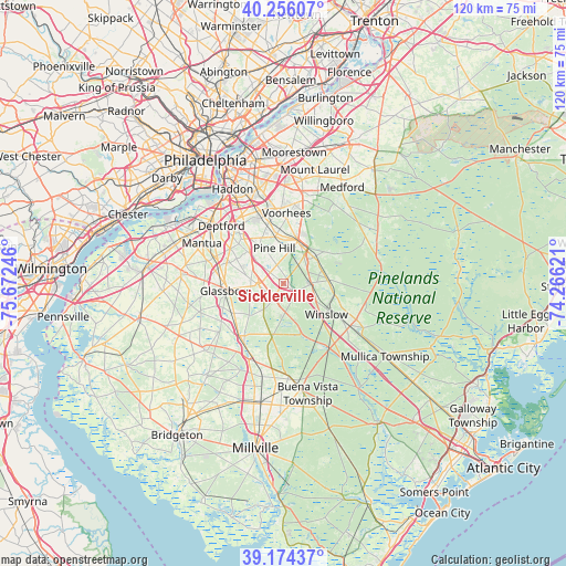
Sicklerville GPS coordinates[2]
39° 43' 2.424" North, 74° 58' 9.588" West
| Map corner | latitude | longitude |
|---|---|---|
| Upper-left | 40.25607°, | -75.67246° |
| Center: | 39.71734°, | -74.96933° |
| Lower-right: | 39.17437°, | -74.26621° |
| Map W x H: | 120.3×120.3 km | = 74.8×74.8mi |
| max Lat: | 71.29058° ⇑49.2% North |
| Sicklerville: | 39.71734° |
| min Lat: | ⇓50.8% South 19.06759° |
| min Long | Sicklerville | max Long |
| -171.73463° | -74.96933° | -66.98998° |
| W 87.4%⇐ | ⇒12.6% E |
Elevation
Elevation of Sicklerville is 43 m = 141 ft, and this is 251.8 m = 826 ft below average elevation for this country.
| Max E: |
3189 m = 10463 ft | 80.9% |
| Avg. | 294.8 m = 967 ft | |
| Sicklerville | 43 m = 141 ft | |
Min E: |
-60 m = -197 ft | 19.1% |
See also: Sicklerville elevation on elevation.city.
Geographical zone
Sicklerville is located in North temperate zone (between Tropic of Cancer and the Arctic Circle). Distance of this Northern Tropic circle is 1810.2 km =1124.8 mi to South.| Distance of | km | miles | from Sicklerville |
|---|---|---|---|
| North Pole | 5590.9 | 3474 | to North |
| Arctic Circle | 2985 | 1854.8 | to North |
| Tropic Cancer | 1810.2 | 1124.8 | to South |
| Equator | 4416.2 | 2744.1 | to South |


Nearby cities:
15 places around Sicklerville: (largest is in red/bold)
• Atco
9.1 km =5.7 mi,  50°
50°
• Berlin
8.9 km =5.5 mi,  22°
22°
• Blackwood
12.4 km =7.7 mi,  319°
319°
• Chesilhurst
7.7 km =4.8 mi,  77°
77°
• Clayton
12.3 km =7.6 mi,  238°
238°
• Clementon
10.5 km =6.5 mi,  353°
353°
• Florence
4.8 km =3 mi,  66°
66°
• Glassboro
12.3 km =7.6 mi,  262°
262°
• Jackson
11.3 km =7 mi, 54°
• Laurel Springs
11.9 km =7.4 mi,  344°
344°
• Lindenwold
12.1 km =7.5 mi, 348°
• Pine Hill
7.7 km =4.8 mi, 345°
• Turnersville
9.4 km =5.8 mi,  311°
311°
• Victory Lakes
9.4 km =5.8 mi,  178°
178°
• Williamstown
4.1 km =2.5 mi,  212°
212°
Sources, notices
• [Note1] Compared only with cities in United States existing in our database
• [Src1] Map data: © OpenStreetMap contributors (CC-BY-SA)
• [Src2] Other city data from geonames.org with taken over terms of usage.
• [Src3] Geographical zone / Annual Mean Temperature by Robert A. Rohde @ Wikipedia
