Clayton geodata
Clayton (New Jersey) is a populated place; located in United States in America/New_York (GMT-4) time zone. With population of 8,493 people, there are 5019 cities with bigger population in this country. Compared to other cities in United States, 50.4% of cities are located further ↓South; 87% of cities are located further ←West and 81.1% of cities have higher elevation than Clayton. Note1
Administrative division(s):
- Level 1: New Jersey
- Level 2: Gloucester County
- Level 3: Borough of Clayton


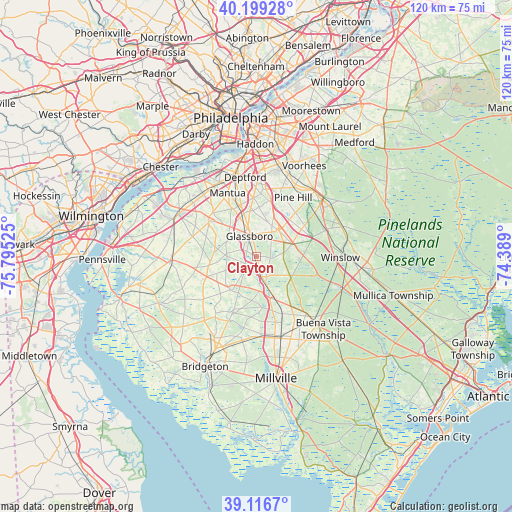
Clayton GPS coordinates[2]
39° 39' 36.396" North, 75° 5' 31.632" West
| Map corner | latitude | longitude |
|---|---|---|
| Upper-left | 40.19928°, | -75.79525° |
| Center: | 39.66011°, | -75.09212° |
| Lower-right: | 39.1167°, | -74.389° |
| Map W x H: | 120.4×120.4 km | = 74.8×74.8mi |
| max Lat: | 71.29058° ⇑49.6% North |
| Clayton: | 39.66011° |
| min Lat: | ⇓50.4% South 19.06759° |
| min Long | Clayton | max Long |
| -171.73463° | -75.09212° | -66.98998° |
| W 87%⇐ | ⇒13% E |
Elevation
Elevation of Clayton is 42 m = 138 ft, and this is 252.8 m = 829 ft below average elevation for this country.
| Max E: |
3189 m = 10463 ft | 81.1% |
| Avg. | 294.8 m = 967 ft | |
| Clayton | 42 m = 138 ft | |
Min E: |
-60 m = -197 ft | 18.9% |
See also: United States elevation on elevation.city.
Geographical zone
Clayton is located in North temperate zone (between Tropic of Cancer and the Arctic Circle). Distance of this Northern Tropic circle is 1803.9 km =1120.9 mi to South.| Distance of | km | miles | from Clayton |
|---|---|---|---|
| North Pole | 5597.3 | 3478 | to North |
| Arctic Circle | 2991.4 | 1858.8 | to North |
| Tropic Cancer | 1803.9 | 1120.9 | to South |
| Equator | 4409.8 | 2740.1 | to South |


Nearby cities:
15 places around Clayton: (largest is in red/bold)
• Blackwood
16 km =9.9 mi,  8°
8°
• Elmer
9.8 km =6.1 mi,  222°
222°
• Glassboro
5 km =3.1 mi,  340°
340°
• Mullica Hill
14.3 km =8.9 mi,  307°
307°
• Newfield
13.8 km =8.6 mi,  155°
155°
• Oak Valley
16.8 km =10.4 mi, 339°
• Olivet
13.5 km =8.4 mi,  203°
203°
• Pine Hill
16.2 km =10.1 mi,  31°
31°
• Pitman
8.8 km =5.5 mi, 337°
• Richwood
9.4 km =5.8 mi,  317°
317°
• Sicklerville
12.3 km =7.6 mi,  58°
58°
• Turnersville
13 km =8.1 mi,  15°
15°
• Victory Lakes
11.2 km =7 mi,  105°
105°
• Wenonah
15.7 km =9.8 mi, 342°
• Williamstown
8.8 km =5.5 mi,  70°
70°
Sources, notices
• [Note1] Compared only with cities in United States existing in our database
• [Src1] Map data: © OpenStreetMap contributors (CC-BY-SA)
• [Src2] Other city data from geonames.org with taken over terms of usage.
• [Src3] Geographical zone / Annual Mean Temperature by Robert A. Rohde @ Wikipedia
