Wood-Lynne geodata
Wood-Lynne (New Jersey) is a populated place; located in United States in America/New_York (GMT-4) time zone. With population of 2,978 people, there are 9670 cities with bigger population in this country. Compared to other cities in United States, 52.7% of cities are located further ↓South; 87% of cities are located further ←West and 93.9% of cities have higher elevation than Wood-Lynne. Note1
Administrative division(s):
- Level 1: New Jersey
- Level 2: Camden County
- Level 3: Borough of Woodlynne


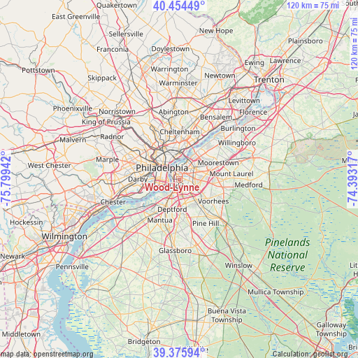
Wood-Lynne GPS coordinates[2]
39° 55' 2.424" North, 75° 5' 46.644" West
| Map corner | latitude | longitude |
|---|---|---|
| Upper-left | 40.45449°, | -75.79942° |
| Center: | 39.91734°, | -75.09629° |
| Lower-right: | 39.37594°, | -74.39317° |
| Map W x H: | 119.9×119.9 km | = 74.5×74.5mi |
| max Lat: | 71.29058° ⇑47.3% North |
| Wood-Lynne: | 39.91734° |
| min Lat: | ⇓52.7% South 19.06759° |
| min Long | Wood-Lynne | max Long |
| -171.73463° | -75.09629° | -66.98998° |
| W 87%⇐ | ⇒13% E |
Elevation
Elevation of Wood-Lynne is 10 m = 33 ft, and this is 284.8 m = 934 ft below average elevation for this country.
| Max E: |
3189 m = 10463 ft | 93.9% |
| Avg. | 294.8 m = 967 ft | |
| Wood-Lynne | 10 m = 33 ft | |
Min E: |
-60 m = -197 ft | 6.1% |
See also: United States elevation on elevation.city.
Geographical zone
Wood-Lynne is located in North temperate zone (between Tropic of Cancer and the Arctic Circle). Distance of this Northern Tropic circle is 1832.5 km =1138.7 mi to South.| Distance of | km | miles | from Wood-Lynne |
|---|---|---|---|
| North Pole | 5568.7 | 3460.2 | to North |
| Arctic Circle | 2962.8 | 1841 | to North |
| Tropic Cancer | 1832.5 | 1138.7 | to South |
| Equator | 4438.4 | 2757.9 | to South |


Nearby cities:
15 places around Wood-Lynne: (largest is in red/bold)
• Audubon
3.5 km =2.2 mi,  145°
145°
• Audubon Park
2.4 km =1.5 mi,  162°
162°
• Brooklawn
4.8 km =3 mi,  205°
205°
• Camden
2.2 km =1.4 mi,  295°
295°
• Collingswood
2.1 km =1.3 mi,  87°
87°
• Gloucester City
3.3 km =2.1 mi, 210°
• Golden Triangle
5 km =3.1 mi,  76°
76°
• Haddon Heights
5.2 km =3.2 mi, 148°
• Merchantville
4.2 km =2.6 mi,  37°
37°
• Mount Ephraim
4.3 km =2.7 mi,  175°
175°
• Oaklyn
2.1 km =1.3 mi, 151°
• Pennsauken
5.4 km =3.4 mi, 37°
• Pennsport
4.8 km =3 mi,  283°
283°
• Wharton
5.3 km =3.3 mi, 281°
• Whitman
5 km =3.1 mi,  269°
269°
Sources, notices
• [Note1] Compared only with cities in United States existing in our database
• [Src1] Map data: © OpenStreetMap contributors (CC-BY-SA)
• [Src2] Other city data from geonames.org with taken over terms of usage.
• [Src3] Geographical zone / Annual Mean Temperature by Robert A. Rohde @ Wikipedia
