Wharton geodata
Wharton (Pennsylvania) is a section of populated place; located in United States in America/New_York (GMT-4) time zone. With population of 49,732 people, there are 957 cities with bigger population in this country. Compared to other cities in United States, 52.8% of cities are located further ↓South; 86.8% of cities are located further ←West and 95.7% of cities have higher elevation than Wharton. Note1
Administrative division(s):
- Level 1: Pennsylvania
- Level 2: Philadelphia County
- Level 3: City of Philadelphia


Wharton GPS coordinates[2]
39° 55' 36.408" North, 75° 9' 25.632" West
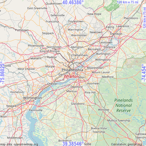
| Map corner | latitude | longitude |
|---|---|---|
| Upper-left | 40.46386°, | -75.86025° |
| Center: | 39.92678°, | -75.15712° |
| Lower-right: | 39.38546°, | -74.454° |
| Map W x H: | 119.9×119.9 km | = 74.5×74.5mi |
| max Lat: | 71.29058° ⇑47.2% North |
| Wharton: | 39.92678° |
| min Lat: | ⇓52.8% South 19.06759° |
| min Long | Wharton | max Long |
| -171.73463° | -75.15712° | -66.98998° |
| W 86.8%⇐ | ⇒13.2% E |
Elevation
Elevation of Wharton is 8 m = 26 ft, and this is 286.8 m = 941 ft below average elevation for this country.
| Max E: |
3189 m = 10463 ft | 95.7% |
| Avg. | 294.8 m = 967 ft | |
| Wharton | 8 m = 26 ft | |
Min E: |
-60 m = -197 ft | 4.3% |
See also: Wharton elevation on elevation.city.
Geographical zone
Wharton is located in North temperate zone (between Tropic of Cancer and the Arctic Circle). Distance of this Northern Tropic circle is 1833.5 km =1139.3 mi to South.| Distance of | km | miles | from Wharton |
|---|---|---|---|
| North Pole | 5567.6 | 3459.5 | to North |
| Arctic Circle | 2961.7 | 1840.3 | to North |
| Tropic Cancer | 1833.5 | 1139.3 | to South |
| Equator | 4439.4 | 2758.5 | to South |


Nearby cities:
15 places around Wharton: (largest is in red/bold)
• Audubon Park
6.8 km =4.2 mi,  119°
119°
• Brooklawn
6.2 km =3.9 mi,  150°
150°
• Camden
3.2 km =2 mi,  91°
91°
• Center City
2.7 km =1.7 mi,  356°
356°
• Collingswood
7.4 km =4.6 mi,  97°
97°
• Gloucester City
5.2 km =3.2 mi,  138°
138°
• Merchantville
8.1 km =5 mi,  73°
73°
• Mount Ephraim
7.7 km =4.8 mi,  134°
134°
• National Park
7 km =4.3 mi,  195°
195°
• Oaklyn
6.8 km =4.2 mi,  114°
114°
• Pennsport
0.6 km =0.4 mi,  80°
80°
• Philadelphia
2.9 km =1.8 mi,  348°
348°
• Westville
6.9 km =4.3 mi,  161°
161°
• Whitman
1.1 km =0.7 mi,  172°
172°
• Wood-Lynne
5.3 km =3.3 mi, 101°
Sources, notices
• [Note1] Compared only with cities in United States existing in our database
• [Src1] Map data: © OpenStreetMap contributors (CC-BY-SA)
• [Src2] Other city data from geonames.org with taken over terms of usage.
• [Src3] Geographical zone / Annual Mean Temperature by Robert A. Rohde @ Wikipedia
