Bainbridge geodata
Bainbridge (Ohio) is a populated place; located in United States in America/New_York (GMT-4) time zone. With population of 852 people, there are 17346 cities with bigger population in this country. Compared to other cities in United States, 52.8% of cities are located further ↑North; 61.2% of cities are located further ←West and 56.4% of cities have lower elevation than Bainbridge. Note1


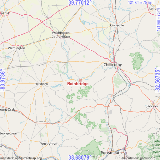
Bainbridge GPS coordinates[2]
39° 13' 39.252" North, 83° 16' 13.692" West
| Map corner | latitude | longitude |
|---|---|---|
| Upper-left | 39.77012°, | -83.9736° |
| Center: | 39.22757°, | -83.27047° |
| Lower-right: | 38.68079°, | -82.56735° |
| Map W x H: | 121.1×121.1 km | = 75.2×75.2mi |
| max Lat: | 71.29058° ⇑52.8% North |
| Bainbridge: | 39.22757° |
| min Lat: | ⇓47.2% South 19.06759° |
| min Long | Bainbridge | max Long |
| -171.73463° | -83.27047° | -66.98998° |
| W 61.2%⇐ | ⇒38.8% E |
Elevation
Elevation of Bainbridge is 224 m = 735 ft, and this is 70.8 m = 232 ft below average elevation for this country.
| Max E: |
3189 m = 10463 ft | 43.6% |
| Avg. | 294.8 m = 967 ft | |
| Bainbridge | 224 m = 735 ft | |
Min E: |
-60 m = -197 ft | 56.4% |
See also: United States elevation on elevation.city.
Geographical zone
Bainbridge is located in North temperate zone (between Tropic of Cancer and the Arctic Circle). Distance of this Northern Tropic circle is 1755.8 km =1091 mi to South.| Distance of | km | miles | from Bainbridge |
|---|---|---|---|
| North Pole | 5645.4 | 3507.9 | to North |
| Arctic Circle | 3039.5 | 1888.7 | to North |
| Tropic Cancer | 1755.8 | 1091 | to South |
| Equator | 4361.7 | 2710.2 | to South |


Nearby cities:
15 places around Bainbridge: (largest is in red/bold)
• Andersonville
31.6 km =19.6 mi,  45°
45°
• Chillicothe
27.4 km =17 mi,  64°
64°
• Frankfort
20.8 km =12.9 mi,  21°
21°
• Greenfield
16.9 km =10.5 mi,  325°
325°
• Highland Holiday
17.5 km =10.9 mi,  258°
258°
• Hillsboro
29.5 km =18.3 mi, 264°
• Leesburg
27.6 km =17.1 mi,  298°
298°
• New Holland
36.3 km =22.6 mi,  1°
1°
• New Vienna
37.7 km =23.4 mi,  286°
286°
• North Fork Village
24 km =14.9 mi, 59°
• Peebles
33.1 km =20.6 mi,  200°
200°
• Piketon
28.3 km =17.6 mi,  128°
128°
• Rocky Fork Point
19.4 km =12.1 mi, 258°
• Washington Court House
37.3 km =23.2 mi,  337°
337°
• Waverly
27 km =16.8 mi,  114°
114°
Sources, notices
• [Note1] Compared only with cities in United States existing in our database
• [Src1] Map data: © OpenStreetMap contributors (CC-BY-SA)
• [Src2] Other city data from geonames.org with taken over terms of usage.
• [Src3] Geographical zone / Annual Mean Temperature by Robert A. Rohde @ Wikipedia
