Chillicothe geodata
Chillicothe (Ohio) is a seat of a second-order administrative division; located in United States in America/New_York (GMT-4) time zone. With population of 21,727 people, there are 2332 cities with bigger population in this country. Compared to other cities in United States, 52% of cities are located further ↑North; 62.1% of cities are located further ←West and 50.5% of cities have higher elevation than Chillicothe. Note1


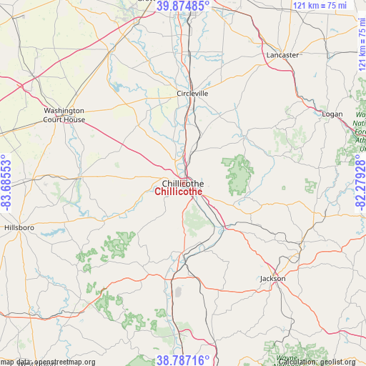
Chillicothe GPS coordinates[2]
39° 19' 59.232" North, 82° 58' 56.64" West
| Map corner | latitude | longitude |
|---|---|---|
| Upper-left | 39.87485°, | -83.68553° |
| Center: | 39.33312°, | -82.9824° |
| Lower-right: | 38.78716°, | -82.27928° |
| Map W x H: | 120.9×120.9 km | = 75.1×75.1mi |
| max Lat: | 71.29058° ⇑52% North |
| Chillicothe: | 39.33312° |
| min Lat: | ⇓48% South 19.06759° |
| min Long | Chillicothe | max Long |
| -171.73463° | -82.9824° | -66.98998° |
| W 62.1%⇐ | ⇒37.9% E |
Elevation
Elevation of Chillicothe is 196 m = 643 ft, and this is 98.8 m = 324 ft below average elevation for this country.
| Max E: |
3189 m = 10463 ft | 50.5% |
| Avg. | 294.8 m = 967 ft | |
| Chillicothe | 196 m = 643 ft | |
Min E: |
-60 m = -197 ft | 49.5% |
See also: United States elevation on elevation.city.
Geographical zone
Chillicothe is located in North temperate zone (between Tropic of Cancer and the Arctic Circle). Distance of this Northern Tropic circle is 1767.5 km =1098.3 mi to South.| Distance of | km | miles | from Chillicothe |
|---|---|---|---|
| North Pole | 5633.6 | 3500.6 | to North |
| Arctic Circle | 3027.7 | 1881.3 | to North |
| Tropic Cancer | 1767.5 | 1098.3 | to South |
| Equator | 4373.4 | 2717.5 | to South |


Nearby cities:
15 places around Chillicothe: (largest is in red/bold)
• Amanda
40.7 km =25.3 mi,  30°
30°
• Andersonville
10.8 km =6.7 mi,  347°
347°
• Bainbridge
27.4 km =17 mi,  244°
244°
• Circleville
29.9 km =18.6 mi,  5°
5°
• Frankfort
18.7 km =11.6 mi,  294°
294°
• Greenfield
34.5 km =21.4 mi,  273°
273°
• Kingston
16.8 km =10.4 mi,  21°
21°
• Laurelville
26.1 km =16.2 mi,  53°
53°
• Logan Elm Village
26.4 km =16.4 mi, 5°
• New Holland
34 km =21.1 mi,  316°
316°
• North Fork Village
4 km =2.5 mi, 274°
• Piketon
29.6 km =18.4 mi,  185°
185°
• Stoutsville
32.9 km =20.4 mi, 23°
• Waverly
22.9 km =14.2 mi,  180°
180°
• Williamsport
30.5 km =19 mi,  337°
337°
Sources, notices
• [Note1] Compared only with cities in United States existing in our database
• [Src1] Map data: © OpenStreetMap contributors (CC-BY-SA)
• [Src2] Other city data from geonames.org with taken over terms of usage.
• [Src3] Geographical zone / Annual Mean Temperature by Robert A. Rohde @ Wikipedia
