Chickasha geodata
Chickasha (Oklahoma) is a seat of a second-order administrative division; located in United States in America/Chicago (GMT-5) time zone. With population of 16,488 people, there are 2977 cities with bigger population in this country. Compared to other cities in United States, 75.1% of cities are located further ↑North; 78.3% of cities are located further →East and 78.2% of cities have lower elevation than Chickasha. Note1


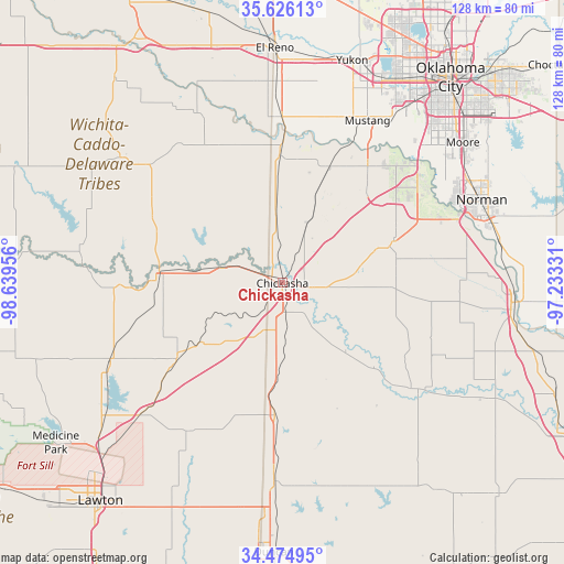
Chickasha GPS coordinates[2]
35° 3' 9.252" North, 97° 56' 11.148" West
| Map corner | latitude | longitude |
|---|---|---|
| Upper-left | 35.62613°, | -98.63956° |
| Center: | 35.05257°, | -97.93643° |
| Lower-right: | 34.47495°, | -97.23331° |
| Map W x H: | 128×128 km | = 79.5×79.5mi |
| max Lat: | 71.29058° ⇑75.1% North |
| Chickasha: | 35.05257° |
| min Lat: | ⇓24.9% South 19.06759° |
| min Long | Chickasha | max Long |
| -171.73463° | -97.93643° | -66.98998° |
| W 21.7%⇐ | ⇒78.3% E |
Elevation
Elevation of Chickasha is 337 m = 1106 ft, and this is 42.2 m = 138 ft above average elevation for this country.
| Max E: |
3189 m = 10463 ft | 21.8% |
| Chickasha | 337 m 1106 ft | |
| Avg. | 294.8 m = 967 ft | |
Min E: |
-60 m = -197 ft | 78.2% |
See also: United States elevation on elevation.city.
Geographical zone
Chickasha is located in North temperate zone (between Tropic of Cancer and the Arctic Circle). Distance of this Northern Tropic circle is 1291.6 km =802.6 mi to South.| Distance of | km | miles | from Chickasha |
|---|---|---|---|
| North Pole | 6109.6 | 3796.3 | to North |
| Arctic Circle | 3503.7 | 2177.1 | to North |
| Tropic Cancer | 1291.6 | 802.6 | to South |
| Equator | 3897.5 | 2421.8 | to South |


Nearby cities:
15 places around Chickasha: (largest is in red/bold)
• Alex
21 km =13 mi,  136°
136°
• Anadarko
28 km =17.4 mi,  274°
274°
• Blanchard
27 km =16.8 mi,  69°
69°
• Cole
33.5 km =20.8 mi,  80°
80°
• Cyril
29.7 km =18.5 mi,  234°
234°
• Dibble
28 km =17.4 mi,  94°
94°
• Fletcher
37.9 km =23.5 mi, 227°
• Lindsay
38.9 km =24.2 mi,  128°
128°
• Minco
28.9 km =18 mi,  358°
358°
• Newcastle
37.5 km =23.3 mi,  54°
54°
• Ninnekah
11.7 km =7.3 mi,  174°
174°
• Rush Springs
30.1 km =18.7 mi,  183°
183°
• Tuttle
28.8 km =17.9 mi,  23°
23°
• Union City
37.7 km =23.4 mi, 359°
• Verden
14.2 km =8.8 mi,  283°
283°
Sources, notices
• [Note1] Compared only with cities in United States existing in our database
• [Src1] Map data: © OpenStreetMap contributors (CC-BY-SA)
• [Src2] Other city data from geonames.org with taken over terms of usage.
• [Src3] Geographical zone / Annual Mean Temperature by Robert A. Rohde @ Wikipedia
