Bertram geodata
Bertram (Texas) is a populated place; located in United States in America/Chicago (GMT-5) time zone. With population of 1,390 people, there are 14160 cities with bigger population in this country. Compared to other cities in United States, 91.2% of cities are located further ↑North; 78.6% of cities are located further →East and 83% of cities have lower elevation than Bertram. Note1


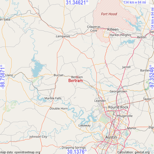
Bertram GPS coordinates[2]
30° 44' 37.68" North, 98° 3' 20.088" West
| Map corner | latitude | longitude |
|---|---|---|
| Upper-left | 31.34621°, | -98.75871° |
| Center: | 30.7438°, | -98.05558° |
| Lower-right: | 30.1376°, | -97.35246° |
| Map W x H: | 134.4×134.4 km | = 83.5×83.5mi |
| max Lat: | 71.29058° ⇑91.2% North |
| Bertram: | 30.7438° |
| min Lat: | ⇓8.8% South 19.06759° |
| min Long | Bertram | max Long |
| -171.73463° | -98.05558° | -66.98998° |
| W 21.4%⇐ | ⇒78.6% E |
Elevation
Elevation of Bertram is 391 m = 1283 ft, and this is 96.2 m = 316 ft above average elevation for this country.
| Max E: |
3189 m = 10463 ft | 17% |
| Bertram | 391 m 1283 ft | |
| Avg. | 294.8 m = 967 ft | |
Min E: |
-60 m = -197 ft | 83% |
See also: United States elevation on elevation.city.
Geographical zone
Bertram is located in North temperate zone (between Tropic of Cancer and the Arctic Circle). Distance of this Northern Tropic circle is 812.5 km =504.9 mi to South.| Distance of | km | miles | from Bertram |
|---|---|---|---|
| North Pole | 6588.7 | 4094 | to North |
| Arctic Circle | 3982.8 | 2474.8 | to North |
| Tropic Cancer | 812.5 | 504.9 | to South |
| Equator | 3418.4 | 2124.1 | to South |


Nearby cities:
15 places around Bertram: (largest is in red/bold)
• Briarcliff
37.4 km =23.2 mi,  178°
178°
• Buchanan Dam
35.9 km =22.3 mi,  269°
269°
• Burnet
16.6 km =10.3 mi,  275°
275°
• Cedar Park
34.8 km =21.6 mi,  139°
139°
• Cottonwood Shores
33.1 km =20.6 mi,  230°
230°
• Florence
27.3 km =17 mi,  66°
66°
• Granite Shoals
35.8 km =22.2 mi,  241°
241°
• Jonestown
30.4 km =18.9 mi,  155°
155°
• Lago Vista
32.2 km =20 mi,  168°
168°
• Leander
26.7 km =16.6 mi,  133°
133°
• Liberty Hill
15.5 km =9.6 mi,  124°
124°
• Marble Falls
27.9 km =17.3 mi, 228°
• Meadowlakes
30.8 km =19.1 mi, 229°
• Serenada
35.1 km =21.8 mi,  98°
98°
• Volente
37.4 km =23.2 mi, 157°
Sources, notices
• [Note1] Compared only with cities in United States existing in our database
• [Src1] Map data: © OpenStreetMap contributors (CC-BY-SA)
• [Src2] Other city data from geonames.org with taken over terms of usage.
• [Src3] Geographical zone / Annual Mean Temperature by Robert A. Rohde @ Wikipedia
