Florence geodata
Florence (Texas) is a populated place; located in United States in America/Chicago (GMT-5) time zone. With population of 1,231 people, there are 14952 cities with bigger population in this country. Compared to other cities in United States, 91% of cities are located further ↑North; 78% of cities are located further →East and 74% of cities have lower elevation than Florence. Note1


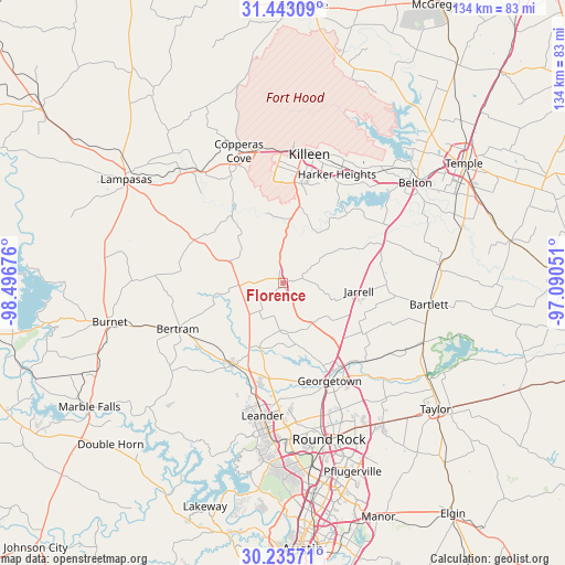
Florence GPS coordinates[2]
30° 50' 28.68" North, 97° 47' 37.068" West
| Map corner | latitude | longitude |
|---|---|---|
| Upper-left | 31.44309°, | -98.49676° |
| Center: | 30.8413°, | -97.79363° |
| Lower-right: | 30.23571°, | -97.09051° |
| Map W x H: | 134.2×134.2 km | = 83.4×83.4mi |
| max Lat: | 71.29058° ⇑91% North |
| Florence: | 30.8413° |
| min Lat: | ⇓9% South 19.06759° |
| min Long | Florence | max Long |
| -171.73463° | -97.79363° | -66.98998° |
| W 22%⇐ | ⇒78% E |
Elevation
Elevation of Florence is 307 m = 1007 ft, and this is 12.2 m = 40 ft above average elevation for this country.
| Max E: |
3189 m = 10463 ft | 26% |
| Florence | 307 m 1007 ft | |
| Avg. | 294.8 m = 967 ft | |
Min E: |
-60 m = -197 ft | 74% |
See also: United States elevation on elevation.city.
Geographical zone
Florence is located in North temperate zone (between Tropic of Cancer and the Arctic Circle). Distance of this Northern Tropic circle is 823.3 km =511.6 mi to South.| Distance of | km | miles | from Florence |
|---|---|---|---|
| North Pole | 6577.8 | 4087.3 | to North |
| Arctic Circle | 3971.9 | 2468 | to North |
| Tropic Cancer | 823.3 | 511.6 | to South |
| Equator | 3429.2 | 2130.8 | to South |


Nearby cities:
15 places around Florence: (largest is in red/bold)
• Bartlett
35.5 km =22.1 mi,  98°
98°
• Bertram
27.3 km =17 mi,  246°
246°
• Copperas Cove
33.1 km =20.6 mi,  341°
341°
• Fort Hood
32.7 km =20.3 mi,  3°
3°
• Georgetown
25.7 km =16 mi,  154°
154°
• Granger
36.2 km =22.5 mi,  112°
112°
• Harker Heights
29.8 km =18.5 mi,  25°
25°
• Jarrell
18.2 km =11.3 mi, 95°
• Kempner
33.3 km =20.7 mi,  323°
323°
• Killeen
31.3 km =19.4 mi,  11°
11°
• Leander
29.7 km =18.5 mi,  191°
191°
• Liberty Hill
23.2 km =14.4 mi,  212°
212°
• Nolanville
31.9 km =19.8 mi, 34°
• Salado
27 km =16.8 mi,  64°
64°
• Serenada
18.5 km =11.5 mi, 148°
Sources, notices
• [Note1] Compared only with cities in United States existing in our database
• [Src1] Map data: © OpenStreetMap contributors (CC-BY-SA)
• [Src2] Other city data from geonames.org with taken over terms of usage.
• [Src3] Geographical zone / Annual Mean Temperature by Robert A. Rohde @ Wikipedia
