Encantada-Ranchito-El Calaboz geodata
Encantada-Ranchito-El Calaboz (Texas) is a populated place; located in United States in America/Chicago (GMT-5) time zone. With population of 2,255 people, there are 11204 cities with bigger population in this country. Compared to other cities in United States, 98.8% of cities are located further ↑North; 77.5% of cities are located further →East and 92.1% of cities have higher elevation than Encantada-Ranchito-El Calaboz. Note1
Current local time in Encantada-Ranchito-El Calaboz:
01:44 AM, TuesdayDifference from your time zone: hours


Encantada-Ranchito-El Calaboz GPS coordinates[2]
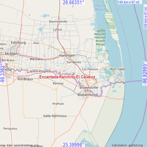
26° 2' 0.384" North, 97° 37' 59.052" West
| Map corner | latitude | longitude |
|---|---|---|
| Upper-left | 26.66351°, | -98.3362° |
| Center: | 26.03344°, | -97.63307° |
| Lower-right: | 25.39996°, | -96.92995° |
| Map W x H: | 140.5×140.5 km | = 87.3×87.3mi |
| max Lat: | 71.29058° ⇑98.8% North |
| Encantada-Ranchito-El Calaboz: | 26.03344° |
| min Lat: | ⇓1.2% South 19.06759° |
| min Long | Encantada-Ranch | max Long |
| -171.73463° | -97.63307° | -66.98998° |
| W 22.5%⇐ | ⇒77.5% E |
Elevation
Elevation of Encantada-Ranchito-El Calaboz is 12 m = 39 ft, and this is 282.8 m = 928 ft below average elevation for this country.
| Max E: |
3189 m = 10463 ft | 92.1% |
| Avg. | 294.8 m = 967 ft | |
| Encantada-Ranchito-El Calaboz | 12 m = 39 ft | |
Min E: |
-60 m = -197 ft | 7.9% |
See also: United States elevation on elevation.city.
Geographical zone
Encantada-Ranchito-El Calaboz is located in North temperate zone (between Tropic of Cancer and the Arctic Circle). Distance of this Northern Tropic circle is 288.7 km =179.4 mi to South.| Distance of | km | miles | from Encantada-Ranchito-El Calaboz |
|---|---|---|---|
| North Pole | 7112.4 | 4419.4 | to North |
| Arctic Circle | 4506.5 | 2800.2 | to North |
| Tropic Cancer | 288.7 | 179.4 | to South |
| Equator | 2894.6 | 1798.6 | to South |


Nearby cities:
15 places around Encantada-Ranchito-El Calaboz: (largest is in red/bold)
• Arroyo Colorado Estates Colonia
17.5 km =10.9 mi,  8°
8°
• Brownsville
20 km =12.4 mi,  137°
137°
• Cameron Park
17.4 km =10.8 mi,  116°
116°
• Cameron Park Colonia
16.9 km =10.5 mi,  114°
114°
• Green Valley Farms
12.2 km =7.6 mi,  36°
36°
• Harlingen
18.6 km =11.6 mi,  340°
340°
• Indian Lake
14.4 km =8.9 mi,  64°
64°
• La Paloma
3.7 km =2.3 mi,  291°
291°
• Laureles
16.2 km =10.1 mi, 58°
• Los Fresnos
16.2 km =10.1 mi,  74°
74°
• Los Indios
11.3 km =7 mi,  278°
278°
• Olmito
10 km =6.2 mi,  97°
97°
• Rancho Viejo
7.7 km =4.8 mi,  84°
84°
• San Benito
11 km =6.8 mi,  1°
1°
• San Pedro
6.8 km =4.2 mi,  147°
147°
Sources, notices
• [Note1] Compared only with cities in United States existing in our database
• [Src1] Map data: © OpenStreetMap contributors (CC-BY-SA)
• [Src2] Other city data from geonames.org with taken over terms of usage.
• [Src3] Geographical zone / Annual Mean Temperature by Robert A. Rohde @ Wikipedia
