Los Indios geodata
Los Indios (Texas) is a populated place; located in United States in America/Chicago (GMT-5) time zone. With population of 1,114 people, there are 15603 cities with bigger population in this country. Compared to other cities in United States, 98.8% of cities are located further ↑North; 77.8% of cities are located further →East and 87.4% of cities have higher elevation than Los Indios. Note1


Los Indios GPS coordinates[2]
26° 2' 57.264" North, 97° 44' 41.964" West
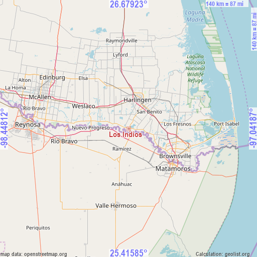
| Map corner | latitude | longitude |
|---|---|---|
| Upper-left | 26.67923°, | -98.44812° |
| Center: | 26.04924°, | -97.74499° |
| Lower-right: | 25.41585°, | -97.04187° |
| Map W x H: | 140.5×140.5 km | = 87.3×87.3mi |
| max Lat: | 71.29058° ⇑98.8% North |
| Los Indios: | 26.04924° |
| min Lat: | ⇓1.2% South 19.06759° |
| min Long | Los Indios | max Long |
| -171.73463° | -97.74499° | -66.98998° |
| W 22.2%⇐ | ⇒77.8% E |
Elevation
Elevation of Los Indios is 22 m = 72 ft, and this is 272.8 m = 895 ft below average elevation for this country.
| Max E: |
3189 m = 10463 ft | 87.4% |
| Avg. | 294.8 m = 967 ft | |
| Los Indios | 22 m = 72 ft | |
Min E: |
-60 m = -197 ft | 12.6% |
See also: United States elevation on elevation.city.
Geographical zone
Los Indios is located in North temperate zone (between Tropic of Cancer and the Arctic Circle). Distance of this Northern Tropic circle is 290.5 km =180.5 mi to South.| Distance of | km | miles | from Los Indios |
|---|---|---|---|
| North Pole | 7110.7 | 4418.4 | to North |
| Arctic Circle | 4504.8 | 2799.2 | to North |
| Tropic Cancer | 290.5 | 180.5 | to South |
| Equator | 2896.4 | 1799.7 | to South |


Nearby cities:
15 places around Los Indios: (largest is in red/bold)
• Bixby
15.7 km =9.8 mi,  316°
316°
• Encantada-Ranchito-El Calaboz
11.3 km =7 mi,  98°
98°
• Green Valley Farms
20.1 km =12.5 mi,  66°
66°
• Harlingen
16.5 km =10.3 mi,  17°
17°
• La Feria
14.5 km =9 mi,  327°
327°
• La Paloma
7.8 km =4.8 mi,  92°
92°
• Las Palmas II
17 km =10.6 mi,  2°
2°
• Mercedes
20.2 km =12.6 mi,  303°
303°
• Palm Valley
17 km =10.6 mi,  356°
356°
• Primera
19.7 km =12.2 mi, 356°
• Rancho Viejo
18.9 km =11.7 mi, 93°
• San Benito
14.7 km =9.1 mi,  50°
50°
• San Pedro
16.6 km =10.3 mi,  116°
116°
• Santa Maria
10.9 km =6.8 mi,  287°
287°
• Solis
15.9 km =9.9 mi, 321°
Sources, notices
• [Note1] Compared only with cities in United States existing in our database
• [Src1] Map data: © OpenStreetMap contributors (CC-BY-SA)
• [Src2] Other city data from geonames.org with taken over terms of usage.
• [Src3] Geographical zone / Annual Mean Temperature by Robert A. Rohde @ Wikipedia
