Fair Oaks Ranch geodata
Fair Oaks Ranch (Texas) is a populated place; located in United States in America/Chicago (GMT-5) time zone. With population of 7,407 people, there are 5587 cities with bigger population in this country. Compared to other cities in United States, 94% of cities are located further ↑North; 79.6% of cities are located further →East and 83% of cities have lower elevation than Fair Oaks Ranch. Note1


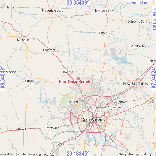
Fair Oaks Ranch GPS coordinates[2]
29° 44' 44.808" North, 98° 38' 36.096" West
| Map corner | latitude | longitude |
|---|---|---|
| Upper-left | 30.35439°, | -99.34649° |
| Center: | 29.74578°, | -98.64336° |
| Lower-right: | 29.13345°, | -97.94024° |
| Map W x H: | 135.8×135.8 km | = 84.4×84.4mi |
| max Lat: | 71.29058° ⇑94% North |
| Fair Oaks Ranch: | 29.74578° |
| min Lat: | ⇓6% South 19.06759° |
| min Long | Fair Oaks Ranch | max Long |
| -171.73463° | -98.64336° | -66.98998° |
| W 20.4%⇐ | ⇒79.6% E |
Elevation
Elevation of Fair Oaks Ranch is 390 m = 1280 ft, and this is 95.2 m = 312 ft above average elevation for this country.
| Max E: |
3189 m = 10463 ft | 17% |
| Fair Oaks Ranch | 390 m 1280 ft | |
| Avg. | 294.8 m = 967 ft | |
Min E: |
-60 m = -197 ft | 83% |
See also: United States elevation on elevation.city.
Geographical zone
Fair Oaks Ranch is located in North temperate zone (between Tropic of Cancer and the Arctic Circle). Distance of this Northern Tropic circle is 701.5 km =435.9 mi to South.| Distance of | km | miles | from Fair Oaks Ranch |
|---|---|---|---|
| North Pole | 6699.6 | 4162.9 | to North |
| Arctic Circle | 4093.8 | 2543.8 | to North |
| Tropic Cancer | 701.5 | 435.9 | to South |
| Equator | 3307.4 | 2055.1 | to South |


Nearby cities:
15 places around Fair Oaks Ranch: (largest is in red/bold)
• Balcones Heights
30 km =18.6 mi,  162°
162°
• Boerne
10.1 km =6.3 mi,  302°
302°
• Bulverde
18.4 km =11.4 mi,  90°
90°
• Castle Hills
27.6 km =17.1 mi,  153°
153°
• Cross Mountain
11.3 km =7 mi,  187°
187°
• Grey Forest
14.9 km =9.3 mi, 194°
• Helotes
19.2 km =11.9 mi, 193°
• Hill Country Village
23.4 km =14.5 mi,  140°
140°
• Hollywood Park
22.1 km =13.7 mi, 136°
• Lakehills
32.9 km =20.4 mi,  241°
241°
• Leon Valley
28 km =17.4 mi,  175°
175°
• Olmos Park
33.3 km =20.7 mi, 153°
• Scenic Oaks
5 km =3.1 mi,  218°
218°
• Shavano Park
19.9 km =12.4 mi, 153°
• Timberwood Park
16.5 km =10.3 mi,  105°
105°
Sources, notices
• [Note1] Compared only with cities in United States existing in our database
• [Src1] Map data: © OpenStreetMap contributors (CC-BY-SA)
• [Src2] Other city data from geonames.org with taken over terms of usage.
• [Src3] Geographical zone / Annual Mean Temperature by Robert A. Rohde @ Wikipedia
