Ganado geodata
Ganado (Texas) is a populated place; located in United States in America/Chicago (GMT-5) time zone. With population of 2,095 people, there are 11636 cities with bigger population in this country. Compared to other cities in United States, 95.2% of cities are located further ↑North; 74.5% of cities are located further →East and 87% of cities have higher elevation than Ganado. Note1


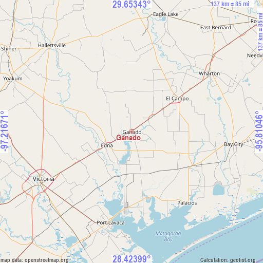
Ganado GPS coordinates[2]
29° 2' 25.944" North, 96° 30' 48.888" West
| Map corner | latitude | longitude |
|---|---|---|
| Upper-left | 29.65343°, | -97.21671° |
| Center: | 29.04054°, | -96.51358° |
| Lower-right: | 28.42399°, | -95.81046° |
| Map W x H: | 136.7×136.7 km | = 84.9×84.9mi |
| max Lat: | 71.29058° ⇑95.2% North |
| Ganado: | 29.04054° |
| min Lat: | ⇓4.8% South 19.06759° |
| min Long | Ganado | max Long |
| -171.73463° | -96.51358° | -66.98998° |
| W 25.5%⇐ | ⇒74.5% E |
Elevation
Elevation of Ganado is 23 m = 75 ft, and this is 271.8 m = 892 ft below average elevation for this country.
| Max E: |
3189 m = 10463 ft | 87% |
| Avg. | 294.8 m = 967 ft | |
| Ganado | 23 m = 75 ft | |
Min E: |
-60 m = -197 ft | 13% |
See also: United States elevation on elevation.city.
Geographical zone
Ganado is located in North temperate zone (between Tropic of Cancer and the Arctic Circle). Distance of this Northern Tropic circle is 623.1 km =387.2 mi to South.| Distance of | km | miles | from Ganado |
|---|---|---|---|
| North Pole | 6778.1 | 4211.7 | to North |
| Arctic Circle | 4172.2 | 2592.5 | to North |
| Tropic Cancer | 623.1 | 387.2 | to South |
| Equator | 3229 | 2006.4 | to South |


Nearby cities:
15 places around Ganado: (largest is in red/bold)
• Bay City
53.3 km =33.1 mi,  96°
96°
• Blessing
34.4 km =21.4 mi,  123°
123°
• Bloomington
57.2 km =35.5 mi,  220°
220°
• Edna
14.6 km =9.1 mi,  241°
241°
• El Campo
29.4 km =18.3 mi,  53°
53°
• Inez
30.7 km =19.1 mi, 240°
• Lolita
22.5 km =14 mi,  187°
187°
• Louise
13.3 km =8.3 mi, 53°
• Markham
44.5 km =27.7 mi, 101°
• Palacios
46.9 km =29.1 mi,  142°
142°
• Placedo
49.4 km =30.7 mi, 218°
• Point Comfort
40.4 km =25.1 mi, 186°
• Port Lavaca
48.6 km =30.2 mi, 193°
• Victoria
54.4 km =33.8 mi, 241°
• Wharton
50 km =31.1 mi, 52°
Sources, notices
• [Note1] Compared only with cities in United States existing in our database
• [Src1] Map data: © OpenStreetMap contributors (CC-BY-SA)
• [Src2] Other city data from geonames.org with taken over terms of usage.
• [Src3] Geographical zone / Annual Mean Temperature by Robert A. Rohde @ Wikipedia
