Haltom City geodata
Haltom City (Texas) is a populated place; located in United States in America/Chicago (GMT-5) time zone. With population of 44,206 people, there are 1078 cities with bigger population in this country. Compared to other cities in United States, 86% of cities are located further ↑North; 76.5% of cities are located further →East and 57.8% of cities have higher elevation than Haltom City. Note1


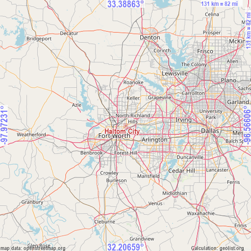
Haltom City GPS coordinates[2]
32° 47' 58.452" North, 97° 16' 9.048" West
| Map corner | latitude | longitude |
|---|---|---|
| Upper-left | 33.38863°, | -97.97231° |
| Center: | 32.79957°, | -97.26918° |
| Lower-right: | 32.20659°, | -96.56606° |
| Map W x H: | 131.4×131.4 km | = 81.6×81.6mi |
| max Lat: | 71.29058° ⇑86% North |
| Haltom City: | 32.79957° |
| min Lat: | ⇓14% South 19.06759° |
| min Long | Haltom City | max Long |
| -171.73463° | -97.26918° | -66.98998° |
| W 23.5%⇐ | ⇒76.5% E |
Elevation
Elevation of Haltom City is 166 m = 545 ft, and this is 128.8 m = 423 ft below average elevation for this country.
| Max E: |
3189 m = 10463 ft | 57.8% |
| Avg. | 294.8 m = 967 ft | |
| Haltom City | 166 m = 545 ft | |
Min E: |
-60 m = -197 ft | 42.2% |
See also: Haltom City elevation on elevation.city.
Geographical zone
Haltom City is located in North temperate zone (between Tropic of Cancer and the Arctic Circle). Distance of this Northern Tropic circle is 1041.1 km =646.9 mi to South.| Distance of | km | miles | from Haltom City |
|---|---|---|---|
| North Pole | 6360.1 | 3952 | to North |
| Arctic Circle | 3754.2 | 2332.8 | to North |
| Tropic Cancer | 1041.1 | 646.9 | to South |
| Equator | 3647 | 2266.1 | to South |


Nearby cities:
15 places around Haltom City: (largest is in red/bold)
• Bedford
12.8 km =8 mi,  67°
67°
• Blue Mound
9.1 km =5.7 mi,  314°
314°
• Colleyville
14 km =8.7 mi,  49°
49°
• Forest Hill
14.2 km =8.8 mi,  180°
180°
• Fort Worth
9.6 km =6 mi,  210°
210°
• Hurst
9.6 km =6 mi, 73°
• North Richland Hills
5.4 km =3.4 mi,  44°
44°
• Pantego
14.2 km =8.8 mi,  131°
131°
• Richland Hills
4.3 km =2.7 mi,  64°
64°
• River Oaks
12 km =7.5 mi,  257°
257°
• Saginaw
11.1 km =6.9 mi, 307°
• Sansom Park
12.5 km =7.8 mi,  273°
273°
• Watauga
6.6 km =4.1 mi,  11°
11°
• Westover Hills
14.8 km =9.2 mi,  245°
245°
• Westworth
14.1 km =8.8 mi, 250°
Sources, notices
• [Note1] Compared only with cities in United States existing in our database
• [Src1] Map data: © OpenStreetMap contributors (CC-BY-SA)
• [Src2] Other city data from geonames.org with taken over terms of usage.
• [Src3] Geographical zone / Annual Mean Temperature by Robert A. Rohde @ Wikipedia
