Pantego geodata
Pantego (Texas) is a populated place; located in United States in America/Chicago (GMT-5) time zone. With population of 2,531 people, there are 10542 cities with bigger population in this country. Compared to other cities in United States, 86.4% of cities are located further ↑North; 76.2% of cities are located further →East and 55.7% of cities have higher elevation than Pantego. Note1


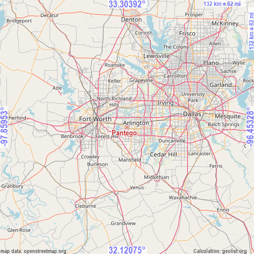
Pantego GPS coordinates[2]
32° 42' 51.48" North, 97° 9' 23.04" West
| Map corner | latitude | longitude |
|---|---|---|
| Upper-left | 33.30392°, | -97.85953° |
| Center: | 32.7143°, | -97.1564° |
| Lower-right: | 32.12075°, | -96.45328° |
| Map W x H: | 131.6×131.6 km | = 81.8×81.8mi |
| max Lat: | 71.29058° ⇑86.4% North |
| Pantego: | 32.7143° |
| min Lat: | ⇓13.6% South 19.06759° |
| min Long | Pantego | max Long |
| -171.73463° | -97.1564° | -66.98998° |
| W 23.8%⇐ | ⇒76.2% E |
Elevation
Elevation of Pantego is 177 m = 581 ft, and this is 117.8 m = 386 ft below average elevation for this country.
| Max E: |
3189 m = 10463 ft | 55.7% |
| Avg. | 294.8 m = 967 ft | |
| Pantego | 177 m = 581 ft | |
Min E: |
-60 m = -197 ft | 44.3% |
See also: United States elevation on elevation.city.
Geographical zone
Pantego is located in North temperate zone (between Tropic of Cancer and the Arctic Circle). Distance of this Northern Tropic circle is 1031.6 km =641 mi to South.| Distance of | km | miles | from Pantego |
|---|---|---|---|
| North Pole | 6369.6 | 3957.9 | to North |
| Arctic Circle | 3763.7 | 2338.7 | to North |
| Tropic Cancer | 1031.6 | 641 | to South |
| Equator | 3637.5 | 2260.2 | to South |


Nearby cities:
15 places around Pantego: (largest is in red/bold)
• Arlington
5.1 km =3.2 mi,  62°
62°
• Bedford
14.5 km =9 mi,  4°
4°
• Dalworthington Gardens
1.3 km =0.8 mi,  175°
175°
• Euless
15.3 km =9.5 mi,  27°
27°
• Everman
15.5 km =9.6 mi,  233°
233°
• Forest Hill
11.6 km =7.2 mi,  246°
246°
• Fort Worth
15.4 km =9.6 mi,  274°
274°
• Grand Prairie
15.2 km =9.4 mi,  76°
76°
• Haltom City
14.2 km =8.8 mi,  311°
311°
• Hurst
12.2 km =7.6 mi,  353°
353°
• Kennedale
9.9 km =6.2 mi,  220°
220°
• Mansfield
16.9 km =10.5 mi, 175°
• North Richland Hills
15 km =9.3 mi,  333°
333°
• Rendon
17.3 km =10.7 mi,  207°
207°
• Richland Hills
13.1 km =8.1 mi, 329°
Sources, notices
• [Note1] Compared only with cities in United States existing in our database
• [Src1] Map data: © OpenStreetMap contributors (CC-BY-SA)
• [Src2] Other city data from geonames.org with taken over terms of usage.
• [Src3] Geographical zone / Annual Mean Temperature by Robert A. Rohde @ Wikipedia
