Liverpool geodata
Liverpool (Texas) is a populated place; located in United States in America/Chicago (GMT-5) time zone. With population of 501 people, there are 20887 cities with bigger population in this country. Compared to other cities in United States, 94.9% of cities are located further ↑North; 71.8% of cities are located further →East and 92.1% of cities have higher elevation than Liverpool. Note1


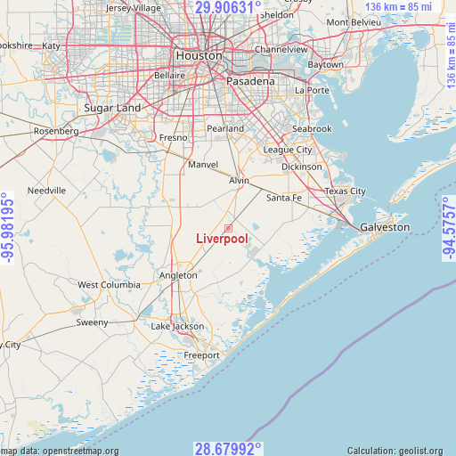
Liverpool GPS coordinates[2]
29° 17' 41.856" North, 95° 16' 43.752" West
| Map corner | latitude | longitude |
|---|---|---|
| Upper-left | 29.90631°, | -95.98195° |
| Center: | 29.29496°, | -95.27882° |
| Lower-right: | 28.67992°, | -94.5757° |
| Map W x H: | 136.4×136.4 km | = 84.8×84.8mi |
| max Lat: | 71.29058° ⇑94.9% North |
| Liverpool: | 29.29496° |
| min Lat: | ⇓5.1% South 19.06759° |
| min Long | Liverpool | max Long |
| -171.73463° | -95.27882° | -66.98998° |
| W 28.2%⇐ | ⇒71.8% E |
Elevation
Elevation of Liverpool is 12 m = 39 ft, and this is 282.8 m = 928 ft below average elevation for this country.
| Max E: |
3189 m = 10463 ft | 92.1% |
| Avg. | 294.8 m = 967 ft | |
| Liverpool | 12 m = 39 ft | |
Min E: |
-60 m = -197 ft | 7.9% |
See also: United States elevation on elevation.city.
Geographical zone
Liverpool is located in North temperate zone (between Tropic of Cancer and the Arctic Circle). Distance of this Northern Tropic circle is 651.4 km =404.8 mi to South.| Distance of | km | miles | from Liverpool |
|---|---|---|---|
| North Pole | 6749.8 | 4194.1 | to North |
| Arctic Circle | 4143.9 | 2574.9 | to North |
| Tropic Cancer | 651.4 | 404.8 | to South |
| Equator | 3257.3 | 2024 | to South |


Nearby cities:
15 places around Liverpool: (largest is in red/bold)
• Alvin
14.7 km =9.1 mi,  13°
13°
• Angleton
20.4 km =12.7 mi,  226°
226°
• Arcola
28.8 km =17.9 mi,  320°
320°
• Bailey Prairie
27.4 km =17 mi, 234°
• Danbury
9.8 km =6.1 mi,  220°
220°
• Dickinson
28.7 km =17.8 mi,  50°
50°
• Friendswood
27.1 km =16.8 mi,  16°
16°
• Hillcrest
11 km =6.8 mi, 9°
• Hitchcock
26.2 km =16.3 mi,  76°
76°
• Holiday Lakes
25 km =15.5 mi,  247°
247°
• Iowa Colony
24.7 km =15.3 mi,  327°
327°
• Manvel
20.2 km =12.6 mi,  337°
337°
• Richwood
29.5 km =18.3 mi,  205°
205°
• Rosharon
18.7 km =11.6 mi,  289°
289°
• Santa Fe
19.1 km =11.9 mi,  61°
61°
Sources, notices
• [Note1] Compared only with cities in United States existing in our database
• [Src1] Map data: © OpenStreetMap contributors (CC-BY-SA)
• [Src2] Other city data from geonames.org with taken over terms of usage.
• [Src3] Geographical zone / Annual Mean Temperature by Robert A. Rohde @ Wikipedia
