Christiansburg geodata
Christiansburg (Virginia) is a seat of a second-order administrative division; located in United States in America/New_York (GMT-4) time zone. With population of 21,943 people, there are 2313 cities with bigger population in this country. Compared to other cities in United States, 65.5% of cities are located further ↑North; 71.2% of cities are located further ←West and 90.2% of cities have lower elevation than Christiansburg. Note1


Christiansburg GPS coordinates[2]
37° 7' 47.46" North, 80° 24' 32.184" West
| Map corner | latitude | longitude |
|---|---|---|
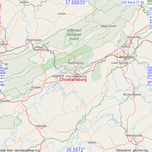
| Upper-left | 37.68835°, | -81.11207° |
| Center: | 37.12985°, | -80.40894° |
| Lower-right: | 36.5672°, | -79.70582° |
| Map W x H: | 124.7×124.7 km | = 77.5×77.5mi |
| max Lat: | 71.29058° ⇑65.5% North |
| Christiansburg: | 37.12985° |
| min Lat: | ⇓34.5% South 19.06759° |
| min Long | Christiansburg | max Long |
| -171.73463° | -80.40894° | -66.98998° |
| W 71.2%⇐ | ⇒28.8% E |
Elevation
Elevation of Christiansburg is 637 m = 2090 ft, and this is 342.2 m = 1123 ft above average elevation for this country.
| Max E: |
3189 m = 10463 ft | 9.8% |
| Christiansburg | 637 m 2090 ft | |
| Avg. | 294.8 m = 967 ft | |
Min E: |
-60 m = -197 ft | 90.2% |
See also: United States elevation on elevation.city.
Geographical zone
Christiansburg is located in North temperate zone (between Tropic of Cancer and the Arctic Circle). Distance of this Northern Tropic circle is 1522.5 km =946 mi to South.| Distance of | km | miles | from Christiansburg |
|---|---|---|---|
| North Pole | 5878.6 | 3652.8 | to North |
| Arctic Circle | 3272.7 | 2033.6 | to North |
| Tropic Cancer | 1522.5 | 946 | to South |
| Equator | 4128.5 | 2565.3 | to South |


Nearby cities:
15 places around Christiansburg: (largest is in red/bold)
• Blacksburg
11.1 km =6.9 mi,  357°
357°
• Dublin
24.7 km =15.3 mi,  263°
263°
• Elliston
18.4 km =11.4 mi,  58°
58°
• Fairlawn
15.2 km =9.4 mi,  277°
277°
• Floyd
25.6 km =15.9 mi,  162°
162°
• Glenvar
29.2 km =18.1 mi, 56°
• Merrimac
6.8 km =4.2 mi,  347°
347°
• Pembroke
29.3 km =18.2 mi,  316°
316°
• Plum Creek
8.1 km =5 mi,  269°
269°
• Prices Fork
11.4 km =7.1 mi, 321°
• Pulaski
34.1 km =21.2 mi,  254°
254°
• Radford
14.9 km =9.3 mi, 270°
• Riner
7.6 km =4.7 mi,  201°
201°
• Salem
36.3 km =22.6 mi, 59°
• Shawsville
14.3 km =8.9 mi,  72°
72°
Sources, notices
• [Note1] Compared only with cities in United States existing in our database
• [Src1] Map data: © OpenStreetMap contributors (CC-BY-SA)
• [Src2] Other city data from geonames.org with taken over terms of usage.
• [Src3] Geographical zone / Annual Mean Temperature by Robert A. Rohde @ Wikipedia
