Fort Lee geodata
Fort Lee (Virginia) is a populated place; located in United States in America/New_York (GMT-4) time zone. With population of 7,520 people, there are 5527 cities with bigger population in this country. Compared to other cities in United States, 64.1% of cities are located further ↑North; 79.4% of cities are located further ←West and 79% of cities have higher elevation than Fort Lee. Note1


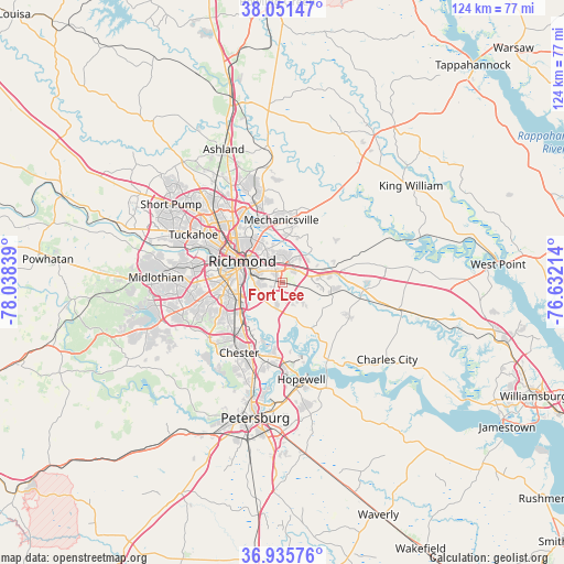
Fort Lee GPS coordinates[2]
37° 29' 44.52" North, 77° 20' 6.936" West
| Map corner | latitude | longitude |
|---|---|---|
| Upper-left | 38.05147°, | -78.03839° |
| Center: | 37.4957°, | -77.33526° |
| Lower-right: | 36.93576°, | -76.63214° |
| Map W x H: | 124.1×124.1 km | = 77.1×77.1mi |
| max Lat: | 71.29058° ⇑64.1% North |
| Fort Lee: | 37.4957° |
| min Lat: | ⇓35.9% South 19.06759° |
| min Long | Fort Lee | max Long |
| -171.73463° | -77.33526° | -66.98998° |
| W 79.4%⇐ | ⇒20.6% E |
Elevation
Elevation of Fort Lee is 51 m = 167 ft, and this is 243.8 m = 800 ft below average elevation for this country.
| Max E: |
3189 m = 10463 ft | 79% |
| Avg. | 294.8 m = 967 ft | |
| Fort Lee | 51 m = 167 ft | |
Min E: |
-60 m = -197 ft | 21% |
See also: United States elevation on elevation.city.
Geographical zone
Fort Lee is located in North temperate zone (between Tropic of Cancer and the Arctic Circle). Distance of this Northern Tropic circle is 1563.2 km =971.3 mi to South.| Distance of | km | miles | from Fort Lee |
|---|---|---|---|
| North Pole | 5837.9 | 3627.5 | to North |
| Arctic Circle | 3232 | 2008.3 | to North |
| Tropic Cancer | 1563.2 | 971.3 | to South |
| Equator | 4169.1 | 2590.6 | to South |


Nearby cities:
15 places around Fort Lee: (largest is in red/bold)
• Bellwood
12.2 km =7.6 mi,  227°
227°
• Bensley
11 km =6.8 mi,  240°
240°
• Bon Air
19.9 km =12.4 mi,  279°
279°
• Chamberlayne
16.7 km =10.4 mi,  330°
330°
• Chester
18.1 km =11.2 mi,  211°
211°
• Dumbarton
18.3 km =11.4 mi,  311°
311°
• East Highland Park
11.4 km =7.1 mi, 326°
• Enon
18.4 km =11.4 mi,  176°
176°
• Highland Springs
5.6 km =3.5 mi,  6°
6°
• Lakeside
17.6 km =10.9 mi, 314°
• Meadowbrook
13.3 km =8.3 mi,  246°
246°
• Mechanicsville
13 km =8.1 mi,  345°
345°
• Montrose
4.7 km =2.9 mi, 306°
• Richmond
12.8 km =8 mi,  300°
300°
• Sandston
3.5 km =2.2 mi,  29°
29°
Sources, notices
• [Note1] Compared only with cities in United States existing in our database
• [Src1] Map data: © OpenStreetMap contributors (CC-BY-SA)
• [Src2] Other city data from geonames.org with taken over terms of usage.
• [Src3] Geographical zone / Annual Mean Temperature by Robert A. Rohde @ Wikipedia
