Massanutten geodata
Massanutten (Virginia) is a populated place; located in United States in America/New_York (GMT-4) time zone. With population of 2,291 people, there are 11101 cities with bigger population in this country. Compared to other cities in United States, 59.3% of cities are located further ↑North; 76.5% of cities are located further ←West and 88.1% of cities have lower elevation than Massanutten. Note1


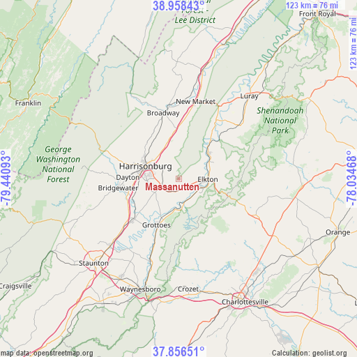
Massanutten GPS coordinates[2]
38° 24' 34.452" North, 78° 44' 16.08" West
| Map corner | latitude | longitude |
|---|---|---|
| Upper-left | 38.95843°, | -79.44093° |
| Center: | 38.40957°, | -78.7378° |
| Lower-right: | 37.85651°, | -78.03468° |
| Map W x H: | 122.5×122.5 km | = 76.1×76.1mi |
| max Lat: | 71.29058° ⇑59.3% North |
| Massanutten: | 38.40957° |
| min Lat: | ⇓40.7% South 19.06759° |
| min Long | Massanutten | max Long |
| -171.73463° | -78.7378° | -66.98998° |
| W 76.5%⇐ | ⇒23.5% E |
Elevation
Elevation of Massanutten is 510 m = 1673 ft, and this is 215.2 m = 706 ft above average elevation for this country.
| Max E: |
3189 m = 10463 ft | 11.9% |
| Massanutten | 510 m 1673 ft | |
| Avg. | 294.8 m = 967 ft | |
Min E: |
-60 m = -197 ft | 88.1% |
See also: United States elevation on elevation.city.
Geographical zone
Massanutten is located in North temperate zone (between Tropic of Cancer and the Arctic Circle). Distance of this Northern Tropic circle is 1664.8 km =1034.5 mi to South.| Distance of | km | miles | from Massanutten |
|---|---|---|---|
| North Pole | 5736.3 | 3564.4 | to North |
| Arctic Circle | 3130.4 | 1945.1 | to North |
| Tropic Cancer | 1664.8 | 1034.5 | to South |
| Equator | 4270.7 | 2653.7 | to South |


Nearby cities:
15 places around Massanutten: (largest is in red/bold)
• Belmont Estates
16.6 km =10.3 mi,  286°
286°
• Bridgewater
21 km =13 mi,  261°
261°
• Broadway
23.3 km =14.5 mi,  346°
346°
• Dayton
17.5 km =10.9 mi,  271°
271°
• Elkton
9.9 km =6.2 mi,  91°
91°
• Grottoes
17.6 km =10.9 mi,  205°
205°
• Harrisonburg
12.3 km =7.6 mi, 291°
• Harriston
22.9 km =14.2 mi,  201°
201°
• Massanetta Springs
8.5 km =5.3 mi, 263°
• Mount Sidney
25.7 km =16 mi,  228°
228°
• New Market
27.1 km =16.8 mi,  12°
12°
• Shenandoah
12.9 km =8 mi,  49°
49°
• Stanley
27.6 km =17.1 mi, 47°
• Timberville
25.7 km =16 mi, 352°
• Weyers Cave
20.4 km =12.7 mi, 228°
Sources, notices
• [Note1] Compared only with cities in United States existing in our database
• [Src1] Map data: © OpenStreetMap contributors (CC-BY-SA)
• [Src2] Other city data from geonames.org with taken over terms of usage.
• [Src3] Geographical zone / Annual Mean Temperature by Robert A. Rohde @ Wikipedia
