Elizabeth geodata
Elizabeth (West Virginia) is a seat of a second-order administrative division; located in United States in America/New_York (GMT-4) time zone. With population of 839 people, there are 17459 cities with bigger population in this country. Compared to other cities in United States, 54.2% of cities are located further ↑North; 68.2% of cities are located further ←West and 50.5% of cities have higher elevation than Elizabeth. Note1


Elizabeth GPS coordinates[2]
39° 3' 48.276" North, 81° 23' 42.432" West
| Map corner | latitude | longitude |
|---|---|---|
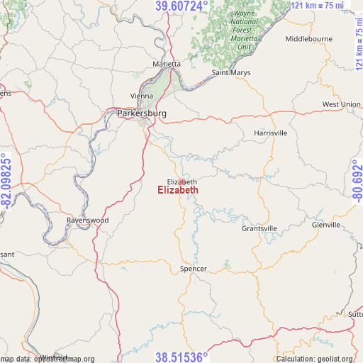
| Upper-left | 39.60724°, | -82.09825° |
| Center: | 39.06341°, | -81.39512° |
| Lower-right: | 38.51536°, | -80.692° |
| Map W x H: | 121.4×121.4 km | = 75.4×75.4mi |
| max Lat: | 71.29058° ⇑54.2% North |
| Elizabeth: | 39.06341° |
| min Lat: | ⇓45.8% South 19.06759° |
| min Long | Elizabeth | max Long |
| -171.73463° | -81.39512° | -66.98998° |
| W 68.2%⇐ | ⇒31.8% E |
Elevation
Elevation of Elizabeth is 196 m = 643 ft, and this is 98.8 m = 324 ft below average elevation for this country.
| Max E: |
3189 m = 10463 ft | 50.5% |
| Avg. | 294.8 m = 967 ft | |
| Elizabeth | 196 m = 643 ft | |
Min E: |
-60 m = -197 ft | 49.5% |
See also: United States elevation on elevation.city.
Geographical zone
Elizabeth is located in North temperate zone (between Tropic of Cancer and the Arctic Circle). Distance of this Northern Tropic circle is 1737.5 km =1079.6 mi to South.| Distance of | km | miles | from Elizabeth |
|---|---|---|---|
| North Pole | 5663.6 | 3519.2 | to North |
| Arctic Circle | 3057.7 | 1900 | to North |
| Tropic Cancer | 1737.5 | 1079.6 | to South |
| Equator | 4343.4 | 2698.9 | to South |


Nearby cities:
15 places around Elizabeth: (largest is in red/bold)
• Belmont
37.1 km =23.1 mi,  18°
18°
• Belpre
28 km =17.4 mi,  326°
326°
• Blennerhassett
30.1 km =18.7 mi,  317°
317°
• Boaz
34.4 km =21.4 mi,  344°
344°
• Grantsville
30.2 km =18.8 mi,  121°
121°
• Harrisville
33.8 km =21 mi,  61°
61°
• Lubeck
27.9 km =17.3 mi,  313°
313°
• Mineral Wells
18.4 km =11.4 mi, 320°
• North Hills
29.9 km =18.6 mi, 340°
• Parkersburg
26.8 km =16.7 mi, 327°
• Ravenswood
34.1 km =21.2 mi,  247°
247°
• Reno
34.4 km =21.4 mi,  359°
359°
• Spencer
29.3 km =18.2 mi,  172°
172°
• Vienna
32.2 km =20 mi, 335°
• Washington
32.4 km =20.1 mi, 312°
Sources, notices
• [Note1] Compared only with cities in United States existing in our database
• [Src1] Map data: © OpenStreetMap contributors (CC-BY-SA)
• [Src2] Other city data from geonames.org with taken over terms of usage.
• [Src3] Geographical zone / Annual Mean Temperature by Robert A. Rohde @ Wikipedia
