Alexandria geodata
Alexandria (Alabama) is a populated place; located in United States in America/Chicago (GMT-5) time zone. With population of 3,917 people, there are 8310 cities with bigger population in this country. Compared to other cities in United States, 81.7% of cities are located further ↑North; 53.2% of cities are located further ←West and 56.4% of cities have higher elevation than Alexandria. Note1


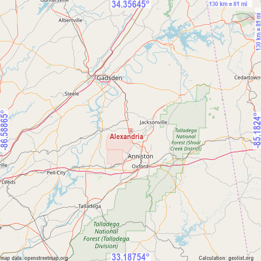
Alexandria GPS coordinates[2]
33° 46' 26.364" North, 85° 53' 7.872" West
| Map corner | latitude | longitude |
|---|---|---|
| Upper-left | 34.35645°, | -86.58865° |
| Center: | 33.77399°, | -85.88552° |
| Lower-right: | 33.18754°, | -85.1824° |
| Map W x H: | 130×130 km | = 80.8×80.8mi |
| max Lat: | 71.29058° ⇑81.7% North |
| Alexandria: | 33.77399° |
| min Lat: | ⇓18.3% South 19.06759° |
| min Long | Alexandria | max Long |
| -171.73463° | -85.88552° | -66.98998° |
| W 53.2%⇐ | ⇒46.8% E |
Elevation
Elevation of Alexandria is 174 m = 571 ft, and this is 120.8 m = 396 ft below average elevation for this country.
| Max E: |
3189 m = 10463 ft | 56.4% |
| Avg. | 294.8 m = 967 ft | |
| Alexandria | 174 m = 571 ft | |
Min E: |
-60 m = -197 ft | 43.6% |
See also: United States elevation on elevation.city.
Geographical zone
Alexandria is located in North temperate zone (between Tropic of Cancer and the Arctic Circle). Distance of this Northern Tropic circle is 1149.4 km =714.2 mi to South.| Distance of | km | miles | from Alexandria |
|---|---|---|---|
| North Pole | 6251.7 | 3884.6 | to North |
| Arctic Circle | 3645.9 | 2265.5 | to North |
| Tropic Cancer | 1149.4 | 714.2 | to South |
| Equator | 3755.3 | 2333.4 | to South |


Nearby cities:
15 places around Alexandria: (largest is in red/bold)
• Anniston
13.6 km =8.5 mi,  158°
158°
• Bynum
19.2 km =11.9 mi,  201°
201°
• Choccolocco
21.1 km =13.1 mi,  127°
127°
• Glencoe
20.8 km =12.9 mi,  347°
347°
• Hobson City
17.4 km =10.8 mi,  167°
167°
• Hokes Bluff
25 km =15.5 mi,  4°
4°
• Jacksonville
12.3 km =7.6 mi,  68°
68°
• Ohatchee
10.9 km =6.8 mi,  275°
275°
• Oxford
18.4 km =11.4 mi, 165°
• Rainbow City
24.8 km =15.4 mi,  324°
324°
• Saks
9.4 km =5.8 mi,  153°
153°
• Southside
21 km =13 mi, 322°
• Weaver
7.3 km =4.5 mi,  109°
109°
• West End-Cobb Town
13.5 km =8.4 mi,  175°
175°
• White Plains
18.4 km =11.4 mi,  99°
99°
Sources, notices
• [Note1] Compared only with cities in United States existing in our database
• [Src1] Map data: © OpenStreetMap contributors (CC-BY-SA)
• [Src2] Other city data from geonames.org with taken over terms of usage.
• [Src3] Geographical zone / Annual Mean Temperature by Robert A. Rohde @ Wikipedia
