South Coventry geodata
South Coventry (Connecticut) is a populated place; located in United States in America/New_York (GMT-4) time zone. With population of 1,483 people, there are 13732 cities with bigger population in this country. Compared to other cities in United States, 73.6% of cities are located further ↓South; 95.2% of cities are located further ←West and 59% of cities have higher elevation than South Coventry. Note1


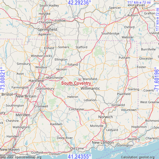
South Coventry GPS coordinates[2]
41° 46' 12.36" North, 72° 18' 18.288" West
| Map corner | latitude | longitude |
|---|---|---|
| Upper-left | 42.29236°, | -73.00821° |
| Center: | 41.7701°, | -72.30508° |
| Lower-right: | 41.24355°, | -71.60196° |
| Map W x H: | 116.6×116.6 km | = 72.5×72.5mi |
| max Lat: | 71.29058° ⇑26.4% North |
| South Coventry: | 41.7701° |
| min Lat: | ⇓73.6% South 19.06759° |
| min Long | South Coventry | max Long |
| -171.73463° | -72.30508° | -66.98998° |
| W 95.2%⇐ | ⇒4.8% E |
Elevation
Elevation of South Coventry is 160 m = 525 ft, and this is 134.8 m = 442 ft below average elevation for this country.
| Max E: |
3189 m = 10463 ft | 59% |
| Avg. | 294.8 m = 967 ft | |
| South Coventry | 160 m = 525 ft | |
Min E: |
-60 m = -197 ft | 41% |
See also: United States elevation on elevation.city.
Geographical zone
South Coventry is located in North temperate zone (between Tropic of Cancer and the Arctic Circle). Distance of this Northern Tropic circle is 2038.5 km =1266.7 mi to South.| Distance of | km | miles | from South Coventry |
|---|---|---|---|
| North Pole | 5362.7 | 3332.2 | to North |
| Arctic Circle | 2756.8 | 1713 | to North |
| Tropic Cancer | 2038.5 | 1266.7 | to South |
| Equator | 4644.4 | 2885.9 | to South |


Nearby cities:
15 places around South Coventry: (largest is in red/bold)
• Coventry Lake
2.3 km =1.4 mi,  276°
276°
• Crystal Lake
19 km =11.8 mi,  341°
341°
• Ellington
20.2 km =12.6 mi,  317°
317°
• Hebron
13.5 km =8.4 mi,  202°
202°
• Manchester
18 km =11.2 mi,  272°
272°
• Mansfield Center
8.9 km =5.5 mi,  93°
93°
• Mansfield City
5.9 km =3.7 mi, 94°
• Rockville
16.1 km =10 mi,  311°
311°
• South Windham
15 km =9.3 mi,  132°
132°
• Stafford Springs
20.5 km =12.7 mi,  0°
0°
• Storrs
6.3 km =3.9 mi,  47°
47°
• Terramuggus
20.3 km =12.6 mi,  222°
222°
• Tolland
12.4 km =7.7 mi,  334°
334°
• Willimantic
10.4 km =6.5 mi, 129°
• Windham
14.6 km =9.1 mi,  122°
122°
Sources, notices
• [Note1] Compared only with cities in United States existing in our database
• [Src1] Map data: © OpenStreetMap contributors (CC-BY-SA)
• [Src2] Other city data from geonames.org with taken over terms of usage.
• [Src3] Geographical zone / Annual Mean Temperature by Robert A. Rohde @ Wikipedia
