New Milford geodata
New Milford (Connecticut) is a populated place; located in United States in America/New_York (GMT-4) time zone. With population of 6,523 people, there are 6097 cities with bigger population in this country. Compared to other cities in United States, 71.6% of cities are located further ↓South; 93% of cities are located further ←West and 74.7% of cities have higher elevation than New Milford. Note1
Administrative division(s):
- Level 1: Connecticut
- Level 2: Litchfield County
- Level 3: Town of New Milford


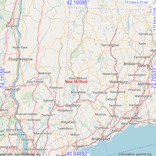
New Milford GPS coordinates[2]
41° 34' 37.344" North, 73° 24' 30.42" West
| Map corner | latitude | longitude |
|---|---|---|
| Upper-left | 42.10088°, | -74.11158° |
| Center: | 41.57704°, | -73.40845° |
| Lower-right: | 41.04892°, | -72.70533° |
| Map W x H: | 117×117 km | = 72.7×72.7mi |
| max Lat: | 71.29058° ⇑28.4% North |
| New Milford: | 41.57704° |
| min Lat: | ⇓71.6% South 19.06759° |
| min Long | New Milford | max Long |
| -171.73463° | -73.40845° | -66.98998° |
| W 93%⇐ | ⇒7% E |
Elevation
Elevation of New Milford is 73 m = 240 ft, and this is 221.8 m = 728 ft below average elevation for this country.
| Max E: |
3189 m = 10463 ft | 74.7% |
| Avg. | 294.8 m = 967 ft | |
| New Milford | 73 m = 240 ft | |
Min E: |
-60 m = -197 ft | 25.3% |
See also: United States elevation on elevation.city.
Geographical zone
New Milford is located in North temperate zone (between Tropic of Cancer and the Arctic Circle). Distance of this Northern Tropic circle is 2017 km =1253.3 mi to South.| Distance of | km | miles | from New Milford |
|---|---|---|---|
| North Pole | 5384.1 | 3345.5 | to North |
| Arctic Circle | 2778.2 | 1726.3 | to North |
| Tropic Cancer | 2017 | 1253.3 | to South |
| Equator | 4622.9 | 2872.5 | to South |


Nearby cities:
15 places around New Milford: (largest is in red/bold)
• Bantam
21.8 km =13.5 mi,  41°
41°
• Bethlehem Village
18.5 km =11.5 mi,  67°
67°
• Danbury
20.6 km =12.8 mi,  190°
190°
• Heritage Village
17.5 km =10.9 mi,  125°
125°
• Kent
17.4 km =10.8 mi,  340°
340°
• New Fairfield
13.9 km =8.6 mi,  207°
207°
• New Preston
11.9 km =7.4 mi,  23°
23°
• Newtown
20.1 km =12.5 mi,  154°
154°
• Pawling
16.2 km =10.1 mi,  264°
264°
• Putnam Lake
17.2 km =10.7 mi,  221°
221°
• Sherman
7.3 km =4.5 mi,  271°
271°
• Southbury
19.4 km =12.1 mi,  123°
123°
• Washington
10.1 km =6.3 mi,  53°
53°
• Woodbury
17 km =10.6 mi,  102°
102°
• Woodbury Center
17.3 km =10.7 mi, 102°
Sources, notices
• [Note1] Compared only with cities in United States existing in our database
• [Src1] Map data: © OpenStreetMap contributors (CC-BY-SA)
• [Src2] Other city data from geonames.org with taken over terms of usage.
• [Src3] Geographical zone / Annual Mean Temperature by Robert A. Rohde @ Wikipedia
