Windsor geodata
Windsor (Connecticut) is a populated place; located in United States in America/New_York (GMT-4) time zone. With population of 28,778 people, there are 1735 cities with bigger population in this country. Compared to other cities in United States, 74.4% of cities are located further ↓South; 94.5% of cities are located further ←West and 89.1% of cities have higher elevation than Windsor. Note1


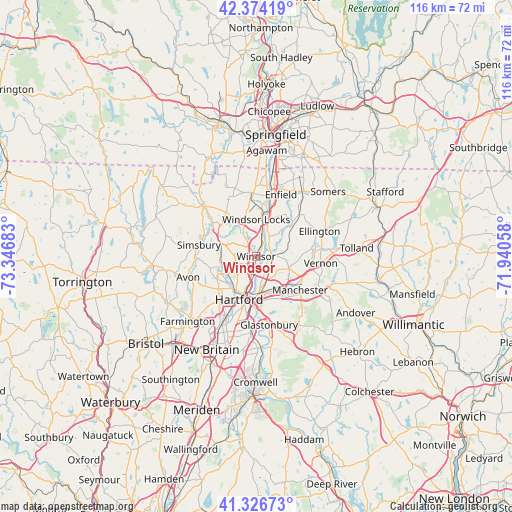
Windsor GPS coordinates[2]
41° 51' 9.36" North, 72° 38' 37.32" West
| Map corner | latitude | longitude |
|---|---|---|
| Upper-left | 42.37419°, | -73.34683° |
| Center: | 41.8526°, | -72.6437° |
| Lower-right: | 41.32673°, | -71.94058° |
| Map W x H: | 116.5×116.5 km | = 72.4×72.4mi |
| max Lat: | 71.29058° ⇑25.6% North |
| Windsor: | 41.8526° |
| min Lat: | ⇓74.4% South 19.06759° |
| min Long | Windsor | max Long |
| -171.73463° | -72.6437° | -66.98998° |
| W 94.5%⇐ | ⇒5.5% E |
Elevation
Elevation of Windsor is 18 m = 59 ft, and this is 276.8 m = 908 ft below average elevation for this country.
| Max E: |
3189 m = 10463 ft | 89.1% |
| Avg. | 294.8 m = 967 ft | |
| Windsor | 18 m = 59 ft | |
Min E: |
-60 m = -197 ft | 10.9% |
See also: United States elevation on elevation.city.
Geographical zone
Windsor is located in North temperate zone (between Tropic of Cancer and the Arctic Circle). Distance of this Northern Tropic circle is 2047.7 km =1272.4 mi to South.| Distance of | km | miles | from Windsor |
|---|---|---|---|
| North Pole | 5353.5 | 3326.5 | to North |
| Arctic Circle | 2747.6 | 1707.3 | to North |
| Tropic Cancer | 2047.7 | 1272.4 | to South |
| Equator | 4653.6 | 2891.6 | to South |


Nearby cities:
15 places around Windsor: (largest is in red/bold)
• Blue Hills
6.3 km =3.9 mi,  225°
225°
• East Hartford
8.2 km =5.1 mi,  161°
161°
• East Windsor
10.5 km =6.5 mi,  50°
50°
• Enfield
14.4 km =8.9 mi,  17°
17°
• Hartford
10.5 km =6.5 mi,  199°
199°
• Manchester
13.2 km =8.2 mi,  130°
130°
• Simsbury Center
14.2 km =8.8 mi,  282°
282°
• South Windsor
3.7 km =2.3 mi,  149°
149°
• Southwood Acres
13.6 km =8.5 mi,  26°
26°
• Suffield Depot
14.3 km =8.9 mi,  357°
357°
• Tariffville
11.5 km =7.1 mi,  302°
302°
• Weatogue
15.3 km =9.5 mi,  266°
266°
• West Hartford
13 km =8.1 mi,  218°
218°
• Wethersfield
15.4 km =9.6 mi,  182°
182°
• Windsor Locks
8.6 km =5.3 mi,  9°
9°
Sources, notices
• [Note1] Compared only with cities in United States existing in our database
• [Src1] Map data: © OpenStreetMap contributors (CC-BY-SA)
• [Src2] Other city data from geonames.org with taken over terms of usage.
• [Src3] Geographical zone / Annual Mean Temperature by Robert A. Rohde @ Wikipedia
