Chillicothe geodata
Chillicothe (Illinois) is a populated place; located in United States in America/Chicago (GMT-5) time zone. With population of 6,226 people, there are 6256 cities with bigger population in this country. Compared to other cities in United States, 65% of cities are located further ↓South; 57.5% of cities are located further →East and 60.1% of cities have higher elevation than Chillicothe. Note1
Administrative division(s):
- Level 1: Illinois
- Level 2: Peoria County
- Level 3: Township of Chillicothe


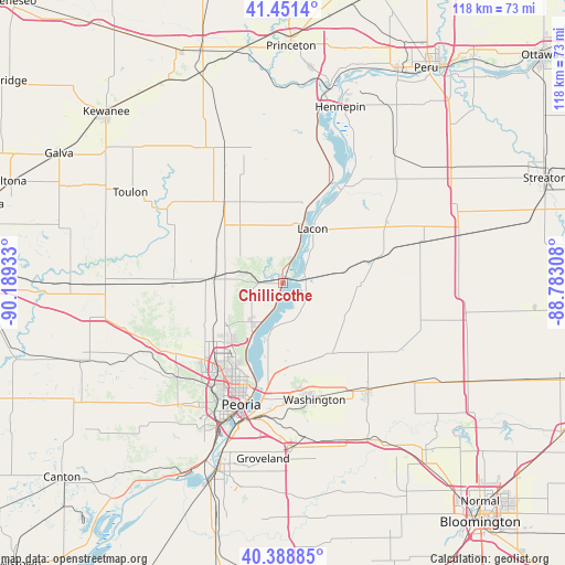
Chillicothe GPS coordinates[2]
40° 55' 20.136" North, 89° 29' 10.32" West
| Map corner | latitude | longitude |
|---|---|---|
| Upper-left | 41.4514°, | -90.18933° |
| Center: | 40.92226°, | -89.4862° |
| Lower-right: | 40.38885°, | -88.78308° |
| Map W x H: | 118.1×118.1 km | = 73.4×73.4mi |
| max Lat: | 71.29058° ⇑35% North |
| Chillicothe: | 40.92226° |
| min Lat: | ⇓65% South 19.06759° |
| min Long | Chillicothe | max Long |
| -171.73463° | -89.4862° | -66.98998° |
| W 42.5%⇐ | ⇒57.5% E |
Elevation
Elevation of Chillicothe is 154 m = 505 ft, and this is 140.8 m = 462 ft below average elevation for this country.
| Max E: |
3189 m = 10463 ft | 60.1% |
| Avg. | 294.8 m = 967 ft | |
| Chillicothe | 154 m = 505 ft | |
Min E: |
-60 m = -197 ft | 39.9% |
See also: United States elevation on elevation.city.
Geographical zone
Chillicothe is located in North temperate zone (between Tropic of Cancer and the Arctic Circle). Distance of this Northern Tropic circle is 1944.2 km =1208.1 mi to South.| Distance of | km | miles | from Chillicothe |
|---|---|---|---|
| North Pole | 5456.9 | 3390.8 | to North |
| Arctic Circle | 2851 | 1771.5 | to North |
| Tropic Cancer | 1944.2 | 1208.1 | to South |
| Equator | 4550.1 | 2827.3 | to South |


Nearby cities:
15 places around Chillicothe: (largest is in red/bold)
• Dunlap
17.5 km =10.9 mi,  247°
247°
• Germantown Hills
17.4 km =10.8 mi,  174°
174°
• Henry
23.7 km =14.7 mi,  27°
27°
• Lacon
13 km =8.1 mi, 28°
• Metamora
18.1 km =11.2 mi,  144°
144°
• North Peoria
24.2 km =15 mi,  199°
199°
• Peoria
26.9 km =16.7 mi, 198°
• Peoria Heights
20.8 km =12.9 mi, 200°
• Princeville
22.8 km =14.2 mi,  272°
272°
• Roanoke
28.1 km =17.5 mi,  119°
119°
• Rome
4.6 km =2.9 mi, 197°
• Washburn
16.4 km =10.2 mi,  91°
91°
• Washington
25.2 km =15.7 mi,  164°
164°
• West Peoria
28.2 km =17.5 mi,  205°
205°
• Wyoming
28.6 km =17.8 mi,  302°
302°
Sources, notices
• [Note1] Compared only with cities in United States existing in our database
• [Src1] Map data: © OpenStreetMap contributors (CC-BY-SA)
• [Src2] Other city data from geonames.org with taken over terms of usage.
• [Src3] Geographical zone / Annual Mean Temperature by Robert A. Rohde @ Wikipedia
