Coyne Center geodata
Coyne Center (Illinois) is a populated place; located in United States in America/Chicago (GMT-5) time zone. With population of 827 people, there are 17545 cities with bigger population in this country. Compared to other cities in United States, 69.8% of cities are located further ↓South; 61% of cities are located further →East and 58.2% of cities have lower elevation than Coyne Center. Note1
Administrative division(s):
- Level 1: Illinois
- Level 2: Rock Island County
- Level 3: Township of Bowling


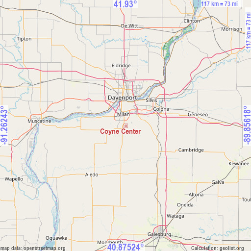
Coyne Center GPS coordinates[2]
41° 24' 17.136" North, 90° 33' 33.48" West
| Map corner | latitude | longitude |
|---|---|---|
| Upper-left | 41.93°, | -91.26243° |
| Center: | 41.40476°, | -90.5593° |
| Lower-right: | 40.87524°, | -89.85618° |
| Map W x H: | 117.3×117.3 km | = 72.9×72.9mi |
| max Lat: | 71.29058° ⇑30.2% North |
| Coyne Center: | 41.40476° |
| min Lat: | ⇓69.8% South 19.06759° |
| min Long | Coyne Center | max Long |
| -171.73463° | -90.5593° | -66.98998° |
| W 39%⇐ | ⇒61% E |
Elevation
Elevation of Coyne Center is 231 m = 758 ft, and this is 63.8 m = 209 ft below average elevation for this country.
| Max E: |
3189 m = 10463 ft | 41.8% |
| Avg. | 294.8 m = 967 ft | |
| Coyne Center | 231 m = 758 ft | |
Min E: |
-60 m = -197 ft | 58.2% |
See also: United States elevation on elevation.city.
Geographical zone
Coyne Center is located in North temperate zone (between Tropic of Cancer and the Arctic Circle). Distance of this Northern Tropic circle is 1997.9 km =1241.4 mi to South.| Distance of | km | miles | from Coyne Center |
|---|---|---|---|
| North Pole | 5403.3 | 3357.5 | to North |
| Arctic Circle | 2797.4 | 1738.2 | to North |
| Tropic Cancer | 1997.9 | 1241.4 | to South |
| Equator | 4603.8 | 2860.7 | to South |


Nearby cities:
15 places around Coyne Center: (largest is in red/bold)
• Andalusia
13.7 km =8.5 mi,  286°
286°
• Bettendorf
13.8 km =8.6 mi,  15°
15°
• Buffalo
14.8 km =9.2 mi, 292°
• Coal Valley
8.6 km =5.3 mi,  72°
72°
• Davenport
13.3 km =8.3 mi,  353°
353°
• East Moline
14.4 km =8.9 mi,  41°
41°
• Matherville
16.6 km =10.3 mi,  194°
194°
• Milan
5.5 km =3.4 mi, 348°
• Moline
11.9 km =7.4 mi, 17°
• Oak Grove
1.1 km =0.7 mi,  304°
304°
• Orion
15.8 km =9.8 mi,  110°
110°
• Reynolds
12.5 km =7.8 mi,  228°
228°
• Rock Island
11.8 km =7.3 mi, 352°
• Sherrard
10.5 km =6.5 mi,  155°
155°
• Silvis
16.9 km =10.5 mi,  45°
45°
Sources, notices
• [Note1] Compared only with cities in United States existing in our database
• [Src1] Map data: © OpenStreetMap contributors (CC-BY-SA)
• [Src2] Other city data from geonames.org with taken over terms of usage.
• [Src3] Geographical zone / Annual Mean Temperature by Robert A. Rohde @ Wikipedia
