Davenport geodata
Davenport (Iowa) is a seat of a second-order administrative division; located in United States in America/Chicago (GMT-5) time zone. With population of 102,582 people, there are 338 cities with bigger population in this country. Compared to other cities in United States, 71.1% of cities are located further ↓South; 61.1% of cities are located further →East and 54.5% of cities have higher elevation than Davenport. Note1


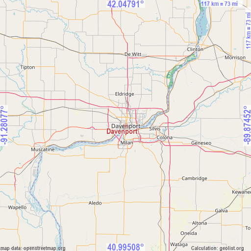
Davenport GPS coordinates[2]
41° 31' 25.104" North, 90° 34' 39.504" West
| Map corner | latitude | longitude |
|---|---|---|
| Upper-left | 42.04791°, | -91.28077° |
| Center: | 41.52364°, | -90.57764° |
| Lower-right: | 40.99508°, | -89.87452° |
| Map W x H: | 117.1×117.1 km | = 72.8×72.8mi |
| max Lat: | 71.29058° ⇑28.9% North |
| Davenport: | 41.52364° |
| min Lat: | ⇓71.1% South 19.06759° |
| min Long | Davenport | max Long |
| -171.73463° | -90.57764° | -66.98998° |
| W 38.9%⇐ | ⇒61.1% E |
Elevation
Elevation of Davenport is 182 m = 597 ft, and this is 112.8 m = 370 ft below average elevation for this country.
| Max E: |
3189 m = 10463 ft | 54.5% |
| Avg. | 294.8 m = 967 ft | |
| Davenport | 182 m = 597 ft | |
Min E: |
-60 m = -197 ft | 45.5% |
See also: Davenport elevation on elevation.city.
Geographical zone
Davenport is located in North temperate zone (between Tropic of Cancer and the Arctic Circle). Distance of this Northern Tropic circle is 2011.1 km =1249.6 mi to South.| Distance of | km | miles | from Davenport |
|---|---|---|---|
| North Pole | 5390.1 | 3349.3 | to North |
| Arctic Circle | 2784.2 | 1730 | to North |
| Tropic Cancer | 2011.1 | 1249.6 | to South |
| Equator | 4617 | 2868.9 | to South |


Nearby cities:
15 places around Davenport: (largest is in red/bold)
• Andalusia
15 km =9.3 mi,  231°
231°
• Bettendorf
5.2 km =3.2 mi,  88°
88°
• Blue Grass
15.8 km =9.8 mi,  264°
264°
• Buffalo
14.3 km =8.9 mi,  238°
238°
• Carbon Cliff
15.9 km =9.9 mi,  101°
101°
• Coal Valley
14.4 km =8.9 mi,  137°
137°
• Coyne Center
13.3 km =8.3 mi,  173°
173°
• East Moline
11.4 km =7.1 mi, 102°
• Eldridge
15 km =9.3 mi,  357°
357°
• Hampton
14.5 km =9 mi,  75°
75°
• Milan
7.9 km =4.9 mi,  176°
176°
• Moline
5.5 km =3.4 mi,  109°
109°
• Oak Grove
12.6 km =7.8 mi, 177°
• Rock Island
1.6 km =1 mi, 183°
• Silvis
13.6 km =8.5 mi, 95°
Sources, notices
• [Note1] Compared only with cities in United States existing in our database
• [Src1] Map data: © OpenStreetMap contributors (CC-BY-SA)
• [Src2] Other city data from geonames.org with taken over terms of usage.
• [Src3] Geographical zone / Annual Mean Temperature by Robert A. Rohde @ Wikipedia
