Moline geodata
Moline (Illinois) is a populated place; located in United States in America/Chicago (GMT-5) time zone. With population of 42,681 people, there are 1124 cities with bigger population in this country. Compared to other cities in United States, 70.9% of cities are located further ↓South; 60.9% of cities are located further →East and 54.8% of cities have higher elevation than Moline. Note1
Administrative division(s):
- Level 1: Illinois
- Level 2: Rock Island County
- Level 3: Township of Moline


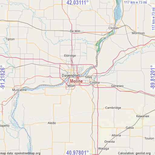
Moline GPS coordinates[2]
41° 30' 24.12" North, 90° 30' 54.468" West
| Map corner | latitude | longitude |
|---|---|---|
| Upper-left | 42.03111°, | -91.21826° |
| Center: | 41.5067°, | -90.51513° |
| Lower-right: | 40.97801°, | -89.81201° |
| Map W x H: | 117.1×117.1 km | = 72.8×72.8mi |
| max Lat: | 71.29058° ⇑29.1% North |
| Moline: | 41.5067° |
| min Lat: | ⇓70.9% South 19.06759° |
| min Long | Moline | max Long |
| -171.73463° | -90.51513° | -66.98998° |
| W 39.1%⇐ | ⇒60.9% E |
Elevation
Elevation of Moline is 181 m = 594 ft, and this is 113.8 m = 373 ft below average elevation for this country.
| Max E: |
3189 m = 10463 ft | 54.8% |
| Avg. | 294.8 m = 967 ft | |
| Moline | 181 m = 594 ft | |
Min E: |
-60 m = -197 ft | 45.2% |
See also: Moline elevation on elevation.city.
Geographical zone
Moline is located in North temperate zone (between Tropic of Cancer and the Arctic Circle). Distance of this Northern Tropic circle is 2009.2 km =1248.5 mi to South.| Distance of | km | miles | from Moline |
|---|---|---|---|
| North Pole | 5391.9 | 3350.4 | to North |
| Arctic Circle | 2786.1 | 1731.2 | to North |
| Tropic Cancer | 2009.2 | 1248.5 | to South |
| Equator | 4615.1 | 2867.7 | to South |


Nearby cities:
15 places around Moline: (largest is in red/bold)
• Bettendorf
2 km =1.2 mi,  358°
358°
• Carbon Cliff
10.4 km =6.5 mi,  97°
97°
• Coal Valley
9.8 km =6.1 mi,  152°
152°
• Colona
13.7 km =8.5 mi, 100°
• Coyne Center
11.9 km =7.4 mi,  197°
197°
• Davenport
5.5 km =3.4 mi,  289°
289°
• East Moline
5.9 km =3.7 mi, 96°
• Green Rock
13.6 km =8.5 mi,  105°
105°
• Hampton
10.4 km =6.5 mi,  58°
58°
• Le Claire
17.6 km =10.9 mi,  54°
54°
• Milan
7.6 km =4.7 mi,  218°
218°
• Oak Grove
11.6 km =7.2 mi, 203°
• Rapids City
16.5 km =10.3 mi, 59°
• Rock Island
5.3 km =3.3 mi,  273°
273°
• Silvis
8.3 km =5.2 mi,  85°
85°
Sources, notices
• [Note1] Compared only with cities in United States existing in our database
• [Src1] Map data: © OpenStreetMap contributors (CC-BY-SA)
• [Src2] Other city data from geonames.org with taken over terms of usage.
• [Src3] Geographical zone / Annual Mean Temperature by Robert A. Rohde @ Wikipedia
