Green Rock geodata
Green Rock (Illinois) is a populated place; located in United States in America/Chicago (GMT-5) time zone. With population of 2,970 people, there are 9681 cities with bigger population in this country. Compared to other cities in United States, 70.5% of cities are located further ↓South; 60.3% of cities are located further →East and 54.5% of cities have higher elevation than Green Rock. Note1


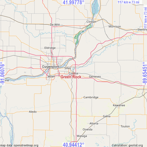
Green Rock GPS coordinates[2]
41° 28' 23.124" North, 90° 21' 27.468" West
| Map corner | latitude | longitude |
|---|---|---|
| Upper-left | 41.99778°, | -91.06076° |
| Center: | 41.47309°, | -90.35763° |
| Lower-right: | 40.94412°, | -89.65451° |
| Map W x H: | 117.2×117.2 km | = 72.8×72.8mi |
| max Lat: | 71.29058° ⇑29.5% North |
| Green Rock: | 41.47309° |
| min Lat: | ⇓70.5% South 19.06759° |
| min Long | Green Rock | max Long |
| -171.73463° | -90.35763° | -66.98998° |
| W 39.7%⇐ | ⇒60.3% E |
Elevation
Elevation of Green Rock is 182 m = 597 ft, and this is 112.8 m = 370 ft below average elevation for this country.
| Max E: |
3189 m = 10463 ft | 54.5% |
| Avg. | 294.8 m = 967 ft | |
| Green Rock | 182 m = 597 ft | |
Min E: |
-60 m = -197 ft | 45.5% |
See also: United States elevation on elevation.city.
Geographical zone
Green Rock is located in North temperate zone (between Tropic of Cancer and the Arctic Circle). Distance of this Northern Tropic circle is 2005.5 km =1246.2 mi to South.| Distance of | km | miles | from Green Rock |
|---|---|---|---|
| North Pole | 5395.7 | 3352.7 | to North |
| Arctic Circle | 2789.8 | 1733.5 | to North |
| Tropic Cancer | 2005.5 | 1246.2 | to South |
| Equator | 4611.4 | 2865.4 | to South |


Nearby cities:
15 places around Green Rock: (largest is in red/bold)
• Bettendorf
14.3 km =8.9 mi,  293°
293°
• Carbon Cliff
3.7 km =2.3 mi,  311°
311°
• Coal Valley
9.9 km =6.2 mi,  240°
240°
• Colona
1.3 km =0.8 mi,  17°
17°
• Coyne Center
18.4 km =11.4 mi,  245°
245°
• East Moline
7.9 km =4.9 mi, 293°
• Geneseo
17.2 km =10.7 mi,  99°
99°
• Hampton
10.2 km =6.3 mi,  334°
334°
• Le Claire
14 km =8.7 mi,  4°
4°
• Milan
18 km =11.2 mi,  262°
262°
• Moline
13.6 km =8.5 mi, 285°
• Orion
13.3 km =8.3 mi,  188°
188°
• Port Byron
14.9 km =9.3 mi,  7°
7°
• Rapids City
12.1 km =7.5 mi, 5°
• Silvis
6.5 km =4 mi, 312°
Sources, notices
• [Note1] Compared only with cities in United States existing in our database
• [Src1] Map data: © OpenStreetMap contributors (CC-BY-SA)
• [Src2] Other city data from geonames.org with taken over terms of usage.
• [Src3] Geographical zone / Annual Mean Temperature by Robert A. Rohde @ Wikipedia
