Rock Falls geodata
Rock Falls (Illinois) is a populated place; located in United States in America/Chicago (GMT-5) time zone. With population of 9,087 people, there are 4769 cities with bigger population in this country. Compared to other cities in United States, 73.7% of cities are located further ↓South; 58.1% of cities are located further →East and 50.5% of cities have lower elevation than Rock Falls. Note1


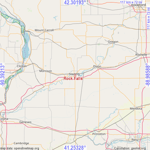
Rock Falls GPS coordinates[2]
41° 46' 47.1" North, 89° 41' 20.4" West
| Map corner | latitude | longitude |
|---|---|---|
| Upper-left | 42.30193°, | -90.39213° |
| Center: | 41.77975°, | -89.689° |
| Lower-right: | 41.25328°, | -88.98588° |
| Map W x H: | 116.6×116.6 km | = 72.5×72.5mi |
| max Lat: | 71.29058° ⇑26.3% North |
| Rock Falls: | 41.77975° |
| min Lat: | ⇓73.7% South 19.06759° |
| min Long | Rock Falls | max Long |
| -171.73463° | -89.689° | -66.98998° |
| W 41.9%⇐ | ⇒58.1% E |
Elevation
Elevation of Rock Falls is 200 m = 656 ft, and this is 94.8 m = 311 ft below average elevation for this country.
| Max E: |
3189 m = 10463 ft | 49.5% |
| Avg. | 294.8 m = 967 ft | |
| Rock Falls | 200 m = 656 ft | |
Min E: |
-60 m = -197 ft | 50.5% |
See also: United States elevation on elevation.city.
Geographical zone
Rock Falls is located in North temperate zone (between Tropic of Cancer and the Arctic Circle). Distance of this Northern Tropic circle is 2039.6 km =1267.3 mi to South.| Distance of | km | miles | from Rock Falls |
|---|---|---|---|
| North Pole | 5361.6 | 3331.5 | to North |
| Arctic Circle | 2755.7 | 1712.3 | to North |
| Tropic Cancer | 2039.6 | 1267.3 | to South |
| Equator | 4645.5 | 2886.6 | to South |


Nearby cities:
15 places around Rock Falls: (largest is in red/bold)
• Amboy
30.8 km =19.1 mi,  103°
103°
• Chadwick
30.9 km =19.2 mi,  327°
327°
• Como
6.6 km =4.1 mi,  257°
257°
• Dixon
18.6 km =11.6 mi,  69°
69°
• Franklin Grove
32.9 km =20.4 mi,  77°
77°
• Lost Nation
30.4 km =18.9 mi,  61°
61°
• Lyndon
20.8 km =12.9 mi,  250°
250°
• Milledgeville
21.6 km =13.4 mi,  340°
340°
• Morrison
23.1 km =14.4 mi,  278°
278°
• Palmyra
12.2 km =7.6 mi,  49°
49°
• Polo
24.7 km =15.3 mi,  21°
21°
• Prophetstown
23.8 km =14.8 mi,  239°
239°
• Sterling
1.2 km =0.7 mi, 328°
• Tampico
18.5 km =11.5 mi,  205°
205°
• Walnut
26 km =16.2 mi,  162°
162°
Sources, notices
• [Note1] Compared only with cities in United States existing in our database
• [Src1] Map data: © OpenStreetMap contributors (CC-BY-SA)
• [Src2] Other city data from geonames.org with taken over terms of usage.
• [Src3] Geographical zone / Annual Mean Temperature by Robert A. Rohde @ Wikipedia
